







The Challenge of a Dynamic Planet
Our planet is not a static rock. Tectonic plates shift, sea levels rise, and the ground itself subtly moves. For decades, scientists have used a combination of powerful techniques to track these changes, creating a global grid called the International
Terrestrial Reference Frame (ITRF). This foundational grid underpins everything from satellite navigation to monitoring ice sheets. However, the ITRF is built by combining data from three different and independent systems: satellite navigation like GPS (or GNSS), Very Long Baseline Interferometry (VLBI) which uses radio telescopes, and Satellite Laser Ranging (SLR). Linking the data from these separate ground stations introduces tiny, millimeter-level errors called "site tie" errors. While a few millimeters may sound trivial, across a global system they limit our ability to detect the smallest, most crucial changes to the Earth system.
Enter GRITSS: A Translator in the Sky
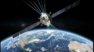
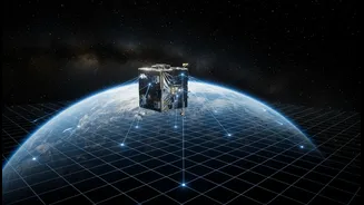
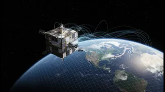
GRITSS, which stands for Geodetic Reference Instrument Transponder for Small Satellites, is a clever solution to this long-standing problem. Developed by NASA in collaboration with the University of Massachusetts Lowell and others, GRITSS is a small satellite, about the size of a suitcase, designed to act as a single, unified reference point in space. Launched into orbit in early July 2026, its mission is to be observable by all three major geodetic techniques simultaneously. By creating a direct link between these systems from space, it aims to eliminate the ground-based "site tie" errors, effectively teaching them to speak the same language. The goal is to help achieve an ITRF with an accuracy of one millimeter, a target set by the Earth Science Decadal Survey.
How the Technology Works
The innovation behind GRITSS is its ability to function as a sophisticated translator. The CubeSat is equipped with a modified GPS receiver that captures standard navigation signals. Onboard processors then instantly convert, or "upconvert," these signals into S-band and X-band frequencies. These are the specific frequencies that the huge radio telescopes of the VLBI network are designed to detect. In simple terms, GRITSS allows a radio telescope on Earth to listen in on GPS signals via the satellite, creating a direct, unbroken link between the two distinct networks. At the same time, the satellite also carries a traditional laser retroreflector, allowing the SLR network to bounce lasers off it for precise distance measurements. By being a common target for all three systems, GRITSS harmonizes the data, removing the discrepancies that arose from trying to stitch it together on the ground.
Why Millimeter Accuracy Matters for India
Achieving millimeter-level accuracy in our planet's measurements has profound implications. For a country like India, with its vast coastline and dynamic geology, the benefits are immense. More precise tracking of sea-level rise can lead to better coastal management and more effective flood defenses. Improved models of tectonic plate movement can enhance our understanding of seismic risks in the Himalayan region. Furthermore, this level of precision is foundational for the next generation of technology. It is crucial for the rollout of 5G networks, which rely on high-precision 3D maps, and is a key ingredient for the future of autonomous vehicles that need to navigate with absolute certainty. Initiatives like India's SVAMITVA scheme, which uses drones to create detailed land-ownership maps, also stand to benefit from a more accurate underlying geodetic framework.
The Road Ahead
The GRITSS satellite, having successfully launched on July 7, 2026, is now in its technology demonstration phase in low Earth orbit. The engineering team is testing its systems and will begin broadcasting signals to NASA's dedicated VLBI stations in the United States. One of the key challenges was designing the satellite to maintain extreme temperature stability to ensure its internal clock doesn't drift by more than a trillionth of a second. The initial mission is planned for one year. If this innovative technique proves successful, the plan is to expand observations to include international partners. Proving the concept could pave the way for a future constellation of similar satellites, providing a continuously updated, ultra-high-resolution map of our ever-changing home planet.