


The All-Weather Eye in the Sky
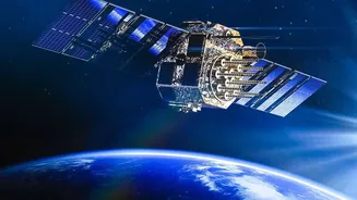
Synthetic Aperture Radar, or SAR, is a game-changing remote sensing technology. Unlike traditional optical satellites that are essentially cameras in orbit and depend on sunlight, SAR is an active system. It sends its own microwave pulses to the Earth's
surface and analyses the signals that bounce back. This gives it a superpower: the ability to create detailed, high-resolution images regardless of weather conditions or time of day. While a cyclone's cloud cover can blind an optical satellite, a SAR satellite can peer right through to map floodwaters on the ground. This capability is invaluable for disaster management, agriculture, urban planning, and national security.
ISRO’s Gateway to Geospatial Learning
Recognising the need for a skilled workforce, ISRO has made learning this advanced technology more accessible than ever. Through its Dehradun-based Indian Institute of Remote Sensing (IIRS), ISRO regularly conducts outreach programmes and free Massive Open Online Courses (MOOCs) on topics like SAR data processing and its applications. These courses are designed for a wide audience, from university students to working professionals, aiming to build a strong foundation in geospatial science. Delivered via a dedicated online platform, these programmes break down complex concepts and provide hands-on knowledge, effectively democratising access to skills that were once confined to specialised research labs.
The Expanding World of Geospatial Careers
The timing for this initiative could not be better. India is in the midst of a geospatial revolution, powered by government initiatives like the National Geospatial Policy 2022. This policy liberalised access to mapping data, sparking innovation and creating enormous demand for trained professionals. India's geospatial economy is projected to grow significantly, creating lakhs of new jobs. Professionals in this field, such as GIS analysts and remote sensing scientists, are the architects of modern decision-making. They help plan smart cities, monitor environmental changes, optimise infrastructure projects, and create more efficient supply chains. Despite the growing demand, there is a noticeable skill gap, making trained candidates highly valuable.
Connecting SAR Skills to Real-World Jobs
So, how does SAR training translate into a career advantage? A student who understands SAR is not just another GIS operator; they are a specialist with a future-proof skill. For instance, in an agricultural technology company, a SAR expert can monitor soil moisture levels to advise on irrigation, something that’s difficult with other technologies. In a disaster management role, they can provide critical intelligence for rescue operations during floods or landslides when visibility is zero. With ISRO's own SAR satellites like the RISAT series and the advanced joint NASA-ISRO NISAR mission generating massive amounts of data, the demand for people who can interpret this information is set to soar.