




From Data Overload to Smart Insights
Modern satellites are powerful eyes in the sky, collecting petabytes of data on everything from weather patterns and crop health to urban expansion and border activities. The sheer volume of this information presents a massive challenge: it's too much
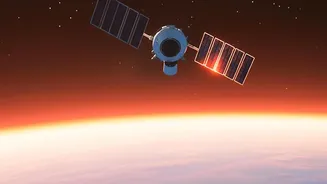
for humans to analyse quickly. This is where AI makes its first, most crucial impact. Instead of beaming enormous raw datasets back to Earth, AI and machine learning algorithms can process information directly on the satellite. This is known as 'edge computing'. It means a satellite can identify a flood, detect illegal deforestation, or spot a change in military hardware, and send back only the actionable insight, not the entire terabyte-sized image. This drastically cuts down the time from data capture to decision-making, which is vital for disaster management and national security.
The Dawn of the Autonomous Satellite
Beyond just processing data, AI is set to take over the driver's seat. Future Indian satellites will use AI for autonomous operations. This includes self-correction of orbits, collision avoidance in increasingly crowded space, and self-diagnosis of technical issues. Think of it as a satellite that can look after itself. This reduces the need for constant human monitoring from ground stations, making missions more resilient and efficient. ISRO has identified AI as a key technology for spacecraft health monitoring and autonomous mission trajectory design. As missions venture further into the solar system, where real-time communication is impossible, this autonomy becomes non-negotiable. It's a fundamental shift from remote-controlled machines to intelligent, independent explorers.
The Private Sector Takes the Lead
While ISRO is laying the foundational strategy, it's India's burgeoning private space-tech sector that is pushing the boundaries of AI integration. Startups are developing satellites that are no longer just data collectors, but intelligent computing nodes in orbit. Companies like Pixxel are using AI to analyse the hyperspectral imagery from their constellations, providing clients with insights on everything from agricultural stress to environmental pollution. Others, like Digantara, are deploying AI-powered sensors to track space debris in real time. In a landmark collaboration, Pixxel and Sarvam AI are even working on an orbital data centre, a satellite designed specifically to run AI models in space, expected to launch in late 2026. This private-sector dynamism, encouraged by government bodies like IN-SPACe, is accelerating innovation and building a robust ecosystem.
A Strategic Imperative for India
The integration of AI into satellites is more than a technological upgrade; it's a strategic imperative. For a nation like India, the applications are profound. AI-powered analysis of satellite imagery can lead to precision agriculture, boosting crop yields and ensuring food security. It can enable faster and more effective disaster response, saving lives during floods, cyclones, and forest fires. On the security front, it provides enhanced surveillance and reconnaissance capabilities. Furthermore, by developing these technologies indigenously, India strengthens its position as a globally competitive space power, capable of offering sophisticated and cost-effective satellite services to other nations. This blend of commercial opportunity and strategic advantage is what makes the fusion of AI and space-tech so critical to India’s future.