







The Forecast: A Strengthening Storm
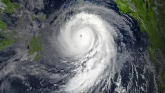
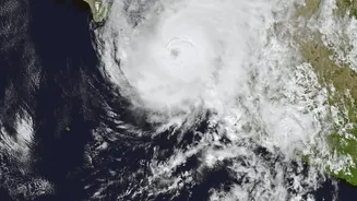
The India Meteorological Department (IMD) has been closely tracking a weather system that developed from a depression in the Bay of Bengal. It officially intensified into a Cyclonic Storm, named 'Akvan', on November 16. The forecast issued on November 17
indicated a high probability of the storm undergoing further intensification in the following days. The prediction was for Akvan to strengthen into a Severe Cyclonic Storm by the evening of November 17, and then into a Very Severe Cyclonic Storm by the morning of November 19. Such an escalation involves a significant increase in wind speed and the overall destructive potential of the weather system.
Did It Intensify as Predicted?
The storm's movement has been slower than initially anticipated. On November 17, Cyclonic Storm Akvan moved north-northwestwards at a very slow pace of about 3 kmph, and at times remained almost stationary. Despite the slow movement, the IMD confirmed on the morning of November 18 that Akvan had indeed intensified into a Severe Cyclonic Storm over the west-central Bay of Bengal. However, some weather experts noted that while it has strengthened, the system's slow progress on November 17 delayed the intensification timeline slightly. The forecast still holds for it to become a Very Severe Cyclonic Storm by November 19.
Current Status and Projected Landfall
As of the morning of November 18, Severe Cyclonic Storm Akvan was located over the west-central Bay of Bengal, approximately 610 km southeast of Machilipatnam and 610 km south-southeast of Visakhapatnam in Andhra Pradesh. The IMD forecasts that the storm will continue to move northwestwards. The projected landfall is expected to occur around noon on November 20, with the storm likely to cross the Andhra Pradesh and Yanam coasts somewhere between Nellore and Tuni. At the time of landfall, it is anticipated to be a Very Severe Cyclonic Storm with maximum sustained wind speeds of 120-130 kmph, gusting up to 145 kmph.
Coastal States on High Alert
In response to the IMD's warnings, several states have begun preparations. Coastal Andhra Pradesh is on the highest alert, as it lies directly in the storm's projected path. The state government has put coastal districts on high alert, issuing warnings to fishermen and preparing for potential evacuations. Extremely heavy rainfall is forecast for several coastal districts of Andhra Pradesh, including Kakinada, Konaseema, West Godavari, and Krishna, on November 19 and 20. Neighbouring states are also on watch. Odisha's southern districts are preparing for heavy rainfall, with some landslide-prone villages identified for pre-emptive evacuation. Heavy rainfall is also expected in parts of Tamil Nadu and Telangana as a result of the cyclone.
Safety Advisories and Official Guidance
The primary advisory from the IMD is a complete suspension of all fishing operations over the west-central and adjoining south Bay of Bengal until November 20. Fishermen have been strongly advised to return to the coast and not venture into the sea. For residents in coastal Andhra Pradesh, a storm surge of approximately 1-2 metres above the astronomical tide is expected to inundate low-lying areas. Authorities have issued Red and Orange alerts for several districts, signalling the need for action and preparedness. Residents in affected areas are urged to secure their homes, keep emergency supplies ready, and follow all instructions from local disaster management officials. It is critical to monitor official updates from the IMD, as the storm's track and intensity can change.