






As Diwali approaches, the familiar glow of diyas and fireworks fills the air. But so does a thick haze. Ever wondered how we get those real-time air quality updates on our phones? It's a fascinating process that turns invisible pollutants into a simple
number.
The Pollutants of Primary Concern
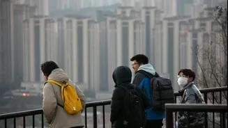
When firecrackers burst, they release a cocktail of harmful substances into the atmosphere. The main culprits that monitoring stations look for are particulate matter, specifically PM2.5 and PM10. These are incredibly tiny particles—many times smaller than a human hair—that can penetrate deep into our lungs and even enter the bloodstream, posing significant health risks. Other monitored pollutants include gases like sulphur dioxide (SO2), nitrogen dioxide (NO2), and carbon monoxide (CO), all of which spike during festive evenings. While the most intense pollution is often short-lived, with air quality returning to pre-festival levels within about 24 hours, the immediate spike can be severe.
The Technology Behind the Data
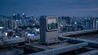
Across India, a network of Continuous Ambient Air Quality Monitoring Stations (CAAQMS) works around the clock. These are essentially small, automated laboratories housed in roadside cabins. To measure particulate matter, many stations use a technique called Beta Attenuation Monitoring (BAM). This technology involves passing a low-energy beta ray through a filter tape. As airborne particles collect on the tape, fewer rays get through. The instrument calculates the mass of the particles based on this reduction in signal. For gaseous pollutants, the methods are different. For example, sulphur dioxide is measured by how it fluoresces under UV light, while carbon monoxide is measured by how much infrared light it absorbs. These sophisticated instruments continuously draw in air and analyze its contents, providing a constant stream of raw data.
From Pollutant Levels to a Single Number: The AQI
Raw data on multiple pollutants can be confusing. That's why India, like many countries, uses an Air Quality Index (AQI). The AQI is a single number that represents the overall air quality. To calculate it, a sub-index is first determined for each of the eight major pollutants monitored, including PM2.5, PM10, CO, and SO2. This is done using a formula that converts the pollutant's measured concentration into a score. The final AQI reported for that location is simply the highest of all the individual sub-indices. This means the AQI always reflects the pollutant that is currently posing the greatest health risk, rather than an average that could mask a dangerous spike in one specific substance.
The Agencies Behind the Monitoring
This vast monitoring effort is coordinated by several key national agencies. The Central Pollution Control Board (CPCB), established in 1974, is the main statutory organisation responsible for setting standards and overseeing air and water quality monitoring across the country. It manages the National Air Quality Monitoring Programme (NAMP). Another major player is the System of Air Quality and Weather Forecasting and Research (SAFAR), an initiative by the Ministry of Earth Sciences. Developed by the Indian Institute of Tropical Meteorology (IITM), SAFAR provides real_time data and forecasts for major metro areas like Delhi, Mumbai, and Pune. Data from monitoring stations run by both the CPCB and SAFAR is collected, processed, and disseminated to the public.
How the Information Reaches You
The final step is getting this crucial information to the public. In the age of IoT, this happens faster than ever. The processed AQI data is pushed to various platforms in near real_time. Government_run websites and mobile apps, such as SAFAR_Air and Sameer, display location_specific AQI values. This information is often colour_coded, ranging from green for 'Good' to maroon for 'Severe', making it easy for anyone to understand the potential health impacts at a glance. This data is also shared with media outlets and displayed on large public digital boards in many cities, ensuring that as the festive evening progresses, everyone has access to the information they need to make decisions about their exposure to polluted air.