






A Fixed Gaze vs. A Passing Glance
The most significant difference lies in the orbit. Conventional Earth-observation (EO) satellites, like those in India's Cartosat or Resourcesat series, operate in a polar, sun-synchronous orbit. They circle the Earth from pole to pole at a low altitude,
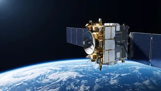
typically under 1,000 kilometres, and pass over the same spot on Earth only at specific intervals, often days apart. Think of it as a train on a fixed schedule, capturing snapshots of stations along its route. GISAT-1A, however, is designed for a geostationary orbit, approximately 36,000 kilometres above the equator. At this altitude, its orbital speed matches the Earth's rotation, making it appear stationary over a specific region. Instead of a passing glance, it offers a persistent, unblinking eye over the Indian subcontinent.
Near Real-Time vs. Periodic Updates
This orbital difference directly impacts how frequently we can get images. Polar-orbiting satellites provide high-resolution images, but their revisit time can be a limitation for monitoring rapidly unfolding events. By the time the satellite passes over the same area again, a flood may have receded or a cyclone's path may have drastically changed. GISAT-1A's geostationary position revolutionises this. It is designed to image the entire Indian landmass every 30 minutes and can be steered to focus on a specific area of interest, capturing images as frequently as every five minutes. This capability transforms monitoring from a periodic check-in to a near real-time watch, which is critical for disaster management and strategic surveillance.
A Strategic Eye for Disasters and Defence
Conventional EO satellites are often specialists. Some are designed for cartography, others for agricultural monitoring, and some for oceanography. GISAT-1A is a powerful generalist with a strategic focus. Its primary mission is to provide rapid intelligence for both civilian and security purposes. For disaster management, it can track the development of cyclones, monitor flooding, and detect forest fires almost as they happen. This allows for quicker response and more effective mitigation efforts. For national security, its ability to maintain a constant watch over India's borders provides an unprecedented advantage in monitoring troop movements, infrastructure changes, and other activities in sensitive areas.
Advanced Imaging for Deeper Insights
While its high orbit means the resolution might not be as fine as some low-orbit spy satellites, GISAT-1A compensates with advanced imaging payloads. It carries instruments that can see in multiple spectral bands, including visible, near-infrared, and short-wave infrared. This allows it to gather more than just a picture; it can obtain 'spectral signatures' that reveal information about crop health, mineralogy, and forest density. This multi-spectral and hyper-spectral capability, combined with its high temporal resolution, provides a rich, multi-layered stream of data that is far more comprehensive than what a standard imager could supply.
The Journey: A Setback and a Comeback
The story of this capability includes a significant challenge. The first satellite in this series, GISAT-1 (also known as EOS-03), failed to reach orbit in August 2021 due to a technical anomaly in the GSLV rocket's cryogenic upper stage. However, ISRO viewed this as a setback, not an end to the program. The designated successor, GISAT-1A (or EOS-05), embodies the same revolutionary concept and is a testament to the strategic importance ISRO places on this technology. The upcoming launch represents a crucial step in finally placing this powerful 'eye in the sky' where it can serve the nation's needs, demonstrating resilience in the face of failure.