



The First Signs of Retreat
Meteorologists are pointing to classic indicators that the monsoon is preparing to withdraw. Recent satellite images show significantly reduced cloud cover over large parts of northwest and central India. This is accompanied by the forecast development
of an anti-cyclonic circulation—a large-scale circulation of winds around a central region of high atmospheric pressure—over northwest India. This weather pattern pushes moisture away and prevents rain-bearing clouds from forming, a key sign that the monsoon is losing its grip. Forecasts from early September show dry, northwesterly winds beginning to push into North India, leading to clearer skies and a temporary pause in rainfall for states like Rajasthan, Punjab, Haryana, and Gujarat. While these are strong indications of a weakening monsoon, the official withdrawal is a gradual process that is declared by the India Meteorological Department (IMD) only after specific conditions are met consistently over several days.
An Erratic and Deficient Season
This year's monsoon has been marked by erratic and uneven distribution. While the country as a whole was facing a rainfall deficit of around 14% by early September, the regional differences have been stark. The South Peninsula and East and Northeast India have been significantly dry, with deficits of 27% and 24% respectively. In contrast, some areas have experienced intense bursts of rain leading to localized flooding, such as in Bareilly, Uttar Pradesh, which broke an all-time monthly rainfall record in a single 24-hour spell. This pattern of long dry spells punctuated by short, intense downpours has been a defining feature of the 2026 monsoon, attributed partly to a strengthening El Niño, which typically suppresses monsoon rainfall in India. The IMD had forecast a below-normal September even before the month began, following what was the hottest August since 1901.
Is the Withdrawal on Schedule?
The normal date for the monsoon to begin its withdrawal from the westernmost parts of Rajasthan is around September 17. Current projections suggest the formal withdrawal process is likely to begin after September 15, which would place it close to the normal timeline. However, an anti-cyclonic circulation is expected to fully mature around September 21, which could organize the withdrawal more formally around that time. In recent years, there has been a trend of delayed monsoon withdrawals. While this year appears to be more aligned with the new normal date, the retreat itself is a slow, weeks-long process. It begins in the northwest and gradually moves southeast across the country. This means that while northern states may begin to experience post-monsoon weather, other parts of central and eastern India could still see active monsoon conditions well into the month.
What This Means for the Rest of India
The withdrawal does not mean an abrupt end to rain for everyone. While northwest India is set to become drier and hotter, weather models indicate a potential low-pressure system could form over the Bay of Bengal between September 12 and 18. This could bring a final spell of rain to parts of East, Central, and North India. However, for Peninsular India, which has already faced a significant rainfall deficit, the IMD has forecast that subdued rainfall activity will likely continue for the first half of September. This lack of 'monsoon withdrawal' rain in the south is a concern for water reservoirs and soil moisture levels, which are crucial for the upcoming rabi crop season.
Impact on Agriculture and Water
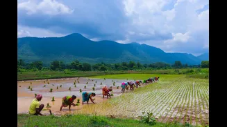
The performance of the tail-end of the monsoon is critical for Indian agriculture. The uneven rainfall this season has already put pressure on water-stressed crops. A timely and well-distributed withdrawal phase is essential for replenishing soil moisture needed for sowing winter crops like wheat, mustard, and gram. With many reservoirs already below their 10-year average levels due to the deficient monsoon, the final rains of September are crucial for shoring up water supplies for irrigation and hydropower. A dry end to the season, particularly in the parched southern peninsula, could affect the planting window and yield of the vital rabi crops, potentially impacting food inflation in the months ahead.