








The Dream vs. The Spreadsheet
We’ve all been there. Someone suggests a trip to Goa or a tour of Rajasthan, and suddenly, the WhatsApp group is flooded with links. One friend wants beach shacks, another wants historic forts, and a third is focused on finding the best vindaloo. The
list of ‘must-sees’ grows until it’s an overwhelming, disconnected jumble of names. Traditionally, the most organised person in the group might try to wrangle this chaos into a spreadsheet. But spreadsheets are linear and abstract; they don’t show you that two ‘must-visit’ spots are on opposite sides of the city, making it impossible to see both in one afternoon. This is where most travel plans die from decision fatigue. The excitement of the initial idea gets lost in the logistical nightmare of trying to please everyone and make sense of a dozen scattered data points.
The Power of a Visual Plan
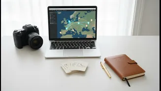
This is where a shared, collaborative map changes the game. By plotting every single wish list item—every restaurant, beach, shop, and temple—onto a single digital map, the dynamic of planning shifts entirely. Abstract names become tangible places with real-world locations. Immediately, you can see what’s possible. Clusters of pins reveal natural neighbourhood-focused days. Outliers can be identified and either made a special priority or saved for another trip. A shared map turns a confusing list into a visual story. It provides a common ground for discussion, allowing everyone in the group to see the same picture and understand the trade-offs. It transforms the conversation from "I want to go here" to "Look, if we do these three things in the morning, we can easily get to that place you wanted to see in the afternoon."
Choosing Your Digital Compass
You don't need expensive software to start. The most powerful tool is one you likely already use: Google Maps. Its lesser-known feature, Google My Maps, is a free and robust platform for this exact purpose. It allows you to create custom maps, add colour-coded pins with notes for different categories (like 'Food', 'Sights', 'Shopping'), and create layers, perhaps one for each day of the trip. Most importantly, these maps can be shared, allowing multiple people to add their ideas and edit the plan in real-time. For those seeking more advanced features, dedicated travel planning apps like Wanderlog offer polished interfaces that integrate itinerary building, booking information, and route optimisation all in one place. Some newer apps like ROILLS are even designed specifically for Indian group travel patterns, including features for splitting costs. The specific tool is less important than the method: get all your ideas in one visual space.
From Pins to a Plan: A Step-by-Step Guide
Ready to build your route? The process is simple: 1. Gather Everything: Collect every suggestion from your group chat, emails, and saved social media posts. Don't filter them yet. 2. Plot Every Pin: Open your shared map (like Google My Maps) and start adding every location. As you add each pin, you can customize it with different icons or colours and add notes, like opening hours or a link to an article. 3. Look for Clusters: Once everything is on the map, zoom out. You’ll immediately see geographic clusters of pins. This is the foundation of your daily itinerary. A tight group of pins in South Mumbai is one day. Another cluster around Old Delhi is another. 4. Collaborate and Cull: Share the map with your travel partners and let them see the plan taking shape. This is the moment to have productive discussions. Is that one remote pin worth a two-hour journey, or should you focus on a denser area? Seeing it on the map makes these decisions easier and less personal. 5. Build the Route: Use your map's layering feature to group pins into daily schedules. Many tools even allow you to draw the route from one point to the next, helping you visualise the flow of your day and estimate travel times.