







1. Near Real-Time Disaster Management
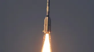
One of the most significant advantages of EOS-05 is its ability to monitor the entire Indian subcontinent continuously from a fixed position about 36,000 km above the Earth. Unlike previous satellites that revisit a location periodically, EOS-05 can provide
images of a selected area every five minutes. This capability is a game-changer for managing fast-moving natural disasters. Authorities can track the development of cyclones, monitor the spread of floods and forest fires in near real-time, and issue timely warnings to save lives and property. This constant watch enables quicker, more informed decision-making during critical events, allowing for better-coordinated rescue and relief efforts.
2. Enhanced National and Border Security
A persistent eye over a large geographical area has profound strategic implications. The EOS-05 will significantly bolster India’s surveillance capabilities along its vast land and sea borders. The ability to frequently image areas of interest helps in monitoring adversary movements and other security-related developments. While many of ISRO's satellites contribute to national security, the geosynchronous nature of EOS-05 provides an unprecedented advantage of constant vigilance over a specific region. This complements the existing constellation of low-earth orbit satellites, creating a multi-layered surveillance architecture that is crucial for strategic planning and tactical responses.
3. Smarter Agriculture and Water Resources Management
Beyond security and disasters, Earth observation data is vital for India's agricultural backbone. The satellite is equipped with multi-spectral and hyper-spectral cameras that can analyze crop health, assess soil moisture, and predict yields with greater accuracy. By monitoring vegetation over large areas, policymakers can make better decisions regarding agricultural planning and food security. Similarly, the satellite will aid in the management of water resources by monitoring reservoirs, rivers, and assessing the impact of drought conditions. This flow of information helps in optimizing water usage for irrigation and other needs, ensuring more sustainable practices.
4. Advanced Weather Forecasting and Climate Monitoring
EOS-05 is set to enhance India's weather forecasting capabilities, particularly in tracking extreme weather events like cloudbursts and thunderstorms. Its ability to observe cloud patterns and atmospheric changes rapidly will provide meteorologists with crucial data for more accurate short-range forecasts. Over the long term, the consistent data collected by the satellite will contribute to a better understanding of climate change impacts. By monitoring changes in glaciers, forest cover, and coastal zones, scientists can build more robust climate models and help the nation adapt to environmental shifts.
5. Aiding Urban and Rural Development
High-quality satellite imagery is a powerful tool for urban planners and rural development agencies. The data from EOS-05 can be used to monitor the pace of urbanization, plan the expansion of cities, and manage infrastructure projects like highways and railways. For rural areas, the information helps in planning the development of essential services and infrastructure. This geospatial data provides a comprehensive view of land use patterns, helping to ensure that development is sustainable and balanced across the country, aligning with national goals for growth and good governance.