





A River That Constantly Changes Its Path
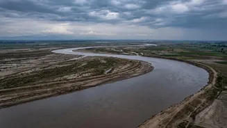
Unlike most rivers that have a fixed, stable channel, the Kosi is infamous for its instability. Over the last two centuries, it has dramatically shifted its course westward by over 100 kilometres, carving new paths through densely populated plains. This
process, called avulsion, means that areas that were once safe can suddenly find themselves in the river's direct path. The most catastrophic recent example was in 2008, when a breach in an embankment near the Nepal border caused the river to abandon its channel and shift eastward by about 120 km. This sudden change affected millions of people in areas that had not seen such flooding in decades.
A Himalayan Conveyor Belt of Silt
The core of the Kosi's destructive power lies in the enormous amount of sediment it carries. Originating in the high Himalayas, the river carves through young, fragile mountains, picking up an exceptional load of silt, sand, and gravel. While the Kosi basin makes up only about 9% of the Ganges river system, it contributes nearly 25% of its total sediment. This amounts to an estimated 100 to 120 million tonnes of silt flowing down every year. As the river descends from the steep mountains onto the flat plains of Bihar, its velocity drops, and it can no longer carry this heavy load. The sediment gets deposited on the riverbed, gradually raising it.
The Embankment Paradox
To control the floods and tame the river, extensive embankments were constructed along the Kosi's banks following an agreement between India and Nepal in 1954. The idea was to confine the river to a single channel. However, this has created a long-term problem. By trapping the river, the embankments also trap its massive sediment load. With nowhere else to go, the silt accumulates between the embankments, raising the riverbed higher and higher. In many places, the Kosi now flows several metres above the surrounding countryside, essentially 'perched' on a man-made ridge of its own sediment. This makes any breach in the embankments incredibly dangerous, as the elevated river can empty out with catastrophic force.
The Nepal Connection and a Cross-Border Challenge
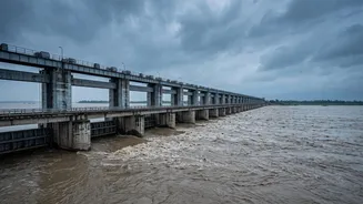
The Kosi is a transboundary river, originating in Tibet and flowing through Nepal before entering India. This means that managing its flow is a complex geopolitical issue. The 1954 Kosi Agreement and its subsequent amendments laid the groundwork for cooperation, leading to the construction of the Kosi Barrage near the border to control water flow for flood management, irrigation, and power generation. However, maintaining the vast network of embankments, especially in Nepalese territory, requires constant vigilance and bilateral coordination. Heavy rainfall and flash floods upstream in Nepal directly impact the water levels downstream in Bihar, necessitating high alerts and rapid response measures in border districts, as seen in the recent warnings issued in August 2026.
An Intensifying Threat
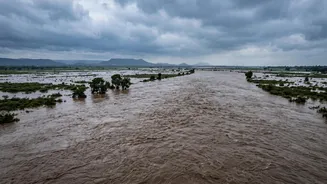
Heavy monsoon rainfall is the immediate trigger for Kosi's floods, but the underlying conditions make it a recurring crisis. The combination of its tendency to shift course, the massive sediment load raising the riverbed, and the paradox of embankments creates a perfect storm. Climate change is expected to further intensify this threat, with predictions of more erratic and intense rainfall events during the monsoon. This would increase erosion in the Himalayas, potentially adding even more sediment to the river system and placing greater stress on existing flood control infrastructure. The annual cycle of destruction has left deep economic and social scars, displacing communities and destroying fertile agricultural land.