






A Groundbreaking Partnership in Orbit
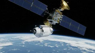
Launched on July 30, 2025, the NASA-ISRO Synthetic Aperture Radar (NISAR) satellite is one of the most sophisticated and expensive Earth-imaging satellites ever built. This ambitious mission is a collaboration between the US and Indian space agencies,
designed to monitor our planet’s complex processes in incredible detail. NISAR orbits the Earth every 12 days, systematically scanning nearly all land and ice surfaces. Its goal is to provide a steady stream of data on everything from the slow crawl of glaciers and the subtle shifting of the Earth’s crust to the health of our forests and agricultural lands. Unlike many other satellites, all of NISAR's data is made freely and publicly available, empowering scientists, policymakers, and the public around the globe.
Seeing the Unseen With Radar
What makes NISAR so special is its technology. It uses Synthetic Aperture Radar (SAR), which can see through obstacles that block traditional optical satellites. Whether it's day or night, cloudy or clear, SAR can produce a high-resolution picture of the Earth's surface. NISAR is the first satellite to use two different radar frequencies, L-band and S-band. This dual-frequency capability allows it to gather even more detailed information. The longer L-band waves, provided by NASA, can penetrate forest canopies to measure biomass, while the shorter S-band waves from ISRO are excellent for monitoring soil moisture and changes in icy regions. This allows the satellite to detect changes on the surface as small as a centimeter.
First Images Reveal a Changing World
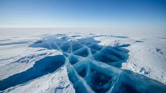
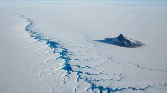
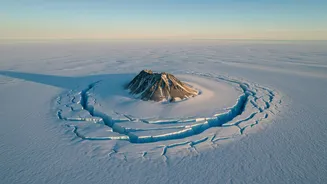
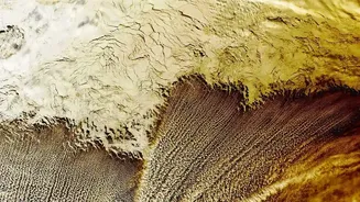
As teams on the ground calibrated the satellite's instruments, NISAR began capturing stunning views of our planet. One of the most striking early images, released in July 2026, shows an Antarctic landscape that resembles a hummingbird. This image is more than just a beautiful accident. It reveals Nunatak Zaterjavshijsja, a mountaintop poking through the ice. The stress created by the flowing ice has caused deep cracks, or crevasses, which are clearly visible in the radar data as sharp green lines. The image showcases NISAR’s power to see details of ice structure and movement that are otherwise hidden. This capability is crucial for tracking the stability of ice sheets, a key factor in rising sea levels. Other initial data has already been used to monitor landslides, earthquakes, and even the sinking of land in Mexico City.
Decoding Earth's Climate Vital Signs
The continuous stream of data from NISAR is a game-changer for climate science. By tracking the flow rate of glaciers and the melting of ice sheets in Antarctica and Greenland, scientists can refine their models of sea-level rise. The satellite’s ability to measure biomass in forests globally will help researchers better understand the planet’s carbon cycle—how much carbon is stored in ecosystems and how much is released into the atmosphere through deforestation. For India, the mission holds particular importance. NISAR will provide critical data for monitoring Himalayan glaciers, which are a vital water source for a huge portion of the population. It can also be used to monitor soil moisture for agriculture, track changes along India's vast coastline, and provide rapid data for disaster response during events like floods and landslides.