
An Eye in the Sky for Global Fields
Historically, assessing crop health and predicting harvests involved on-the-ground surveys and statistical guesswork. This process was often slow, expensive, and difficult to conduct in remote or conflict-affected regions. Today, Earth-observing satellites
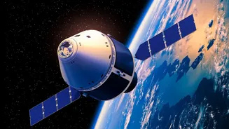
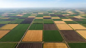
provide a game-changing alternative. These advanced tools orbit the planet, continuously capturing high-resolution images of the world's agricultural lands. This remote sensing technology allows governments, researchers, and farmers to monitor vast areas quickly and efficiently, providing a timely stream of data that was once impossible to obtain. Organizations like the NASA Harvest program and the international Group on Earth Observation's Global Agricultural Monitoring Initiative (GEOGLAM) are at the forefront of this effort. They work to make satellite data accessible and actionable for everyone from policymakers to smallholder farmers, aiming to improve food market transparency and reduce uncertainty.
Seeing Beyond the Visible Spectrum
Satellites see more than just a picture of a field; they collect data across different wavelengths of light, including those invisible to the human eye. One of the most critical tools is multispectral and hyperspectral imaging, which can reveal the health of vegetation. By analyzing how plants reflect light, scientists can calculate indices like the Normalized Difference Vegetation Index (NDVI), a key indicator of plant vigor. Healthy, dense vegetation reflects light differently than stressed or sparse crops. This allows analysts to spot signs of trouble—such as drought stress, nutrient deficiencies, or pest infestations—often before they become visible on the ground. Furthermore, satellites equipped with microwave sensors can measure soil moisture even through clouds, providing early warnings for potential droughts. This wealth of data paints a detailed, near real-time picture of crop conditions across the globe.
From Raw Data to Actionable Intelligence
Collecting data is only the first step. The true power of this technology lies in turning billions of data points into clear, actionable insights. This is where artificial intelligence (AI) and machine learning come in. Sophisticated algorithms process satellite imagery alongside other information like weather forecasts and historical yield data. These models can identify crop types, estimate the total planted area, and forecast production volumes with increasing accuracy. By combining these inputs, organizations can predict potential food shortfalls months in advance. This early warning allows governments and humanitarian groups to act proactively, delivering aid, managing food reserves, and stabilizing markets before a crisis escalates. For example, India's Pradhan Mantri Fasal Bima Yojana crop insurance program uses remote sensing to verify damage claims faster, ensuring farmers receive timely support.
Global Collaboration in Action
This technological leap is not happening in a vacuum. It is driven by global collaboration. GEOGLAM, for instance, provides monthly Crop Monitor reports that synthesize information from various space agencies and agricultural experts. These reports are a consensus-based assessment of crop conditions for major commodities like wheat, maize, rice, and soybeans, highlighting areas of concern around the world. This information is vital for programs like the Famine Early Warning Systems Network (FEWS NET), which uses satellite data to identify regions at risk of acute food insecurity. In one case study in Malawi, GEOGLAM worked with the government and the UN's Food and Agriculture Organization (FAO) to provide timely crop condition updates that informed national planning and food security interventions. These initiatives demonstrate the power of combining advanced technology with international partnership to create a more resilient global food system.
Challenges on the Horizon
Despite its immense potential, the use of satellite data is not without challenges. Persistent cloud cover in tropical regions can obscure optical satellite imagery, making consistent monitoring difficult. Distinguishing the specific cause of crop stress—whether it's drought, pests, or disease—from spectral data alone can also be complex. Furthermore, ensuring the models are accurate requires high-quality ground data for calibration, which can be difficult and expensive to collect, especially in underserved regions. The cost of processing vast amounts of data and the need for specialized expertise can also be barriers to wider adoption. However, as satellite technology becomes more advanced, data becomes more accessible, and AI models grow more sophisticated, these hurdles are gradually being overcome.