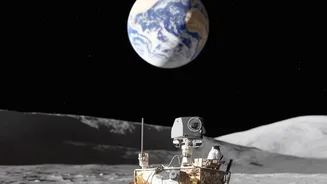







An Off-World Problem
The Global Positioning System (GPS) that powers our smartphones and car navigation relies on a constellation of dozens of satellites orbiting Earth. These satellites constantly broadcast signals that a receiver on the ground uses to calculate its precise
location. Without this orbital infrastructure, the system is useless. The Moon, a silent, airless world, has no such network. This presents a monumental challenge for the next generation of robotic and human missions, including NASA's ambitious Artemis program, which aims to establish a sustainable human presence there. Getting lost on Earth is an inconvenience; getting lost on the Moon could mean the failure of a multi-billion dollar mission, the loss of irreplaceable scientific data, or a life-threatening situation for astronauts. Navigating the rugged, crater-filled lunar south pole—a key target for future missions due to its potential for water ice—is especially perilous with its long, dark shadows and treacherous terrain.
Building a 'LunaNet' from Scratch
The most direct solution is to build a dedicated communications and navigation network for the Moon. Both NASA and the European Space Agency (ESA) are actively developing this exact concept. NASA's version is called LunaNet, an ambitious architecture designed to be an 'internet' for the Moon. It's not just a GPS clone but an integrated network providing communication, navigation, and timing (PNT) services. Similarly, ESA's Moonlight initiative aims to create a constellation of lunar satellites to provide reliable connectivity and positioning. These systems would function like celestial lighthouses, allowing landers, rovers, and even astronauts to pinpoint their location with an accuracy of just a few meters. This infrastructure is seen as essential for enabling a true lunar economy, where multiple government and commercial missions can operate simultaneously and safely.
Navigating by Looking at the Ground
While a satellite network is the ultimate goal, it won't be fully operational overnight. In the meantime, rovers will rely on clever, self-contained techniques. One of the most promising is Terrain Relative Navigation (TRN). TRN works by using cameras or LiDAR sensors to take pictures of the surrounding landscape and then matching those images to high-resolution orbital maps of the Moon's surface. By identifying unique craters, rocks, and ridges, a rover can determine its position without any external signals. Think of it like a hiker recognizing mountains on the horizon to figure out their location on a paper map. This technology has already been proven effective for landing spacecraft on Mars and is being adapted for lunar missions. Another method, called visual odometry, tracks the rover's movement by analyzing how the surface appears to shift between consecutive images, allowing it to calculate how far it has traveled and in what direction.
The Rise of Commercial Solutions
The challenge of lunar navigation has sparked a new commercial space race. Instead of building all the technology in-house, space agencies are partnering with private companies to develop these crucial systems. Companies like Telespazio are leading consortia to build out ESA's Moonlight constellation, while others like Intuitive Machines have been selected by NASA to deliver the first relay satellites for LunaNet. This public-private partnership model is designed to accelerate development, reduce costs, and foster innovation. Firms are developing everything from the satellite buses to the complex flight software and ground stations. This creates a new market for in-space infrastructure, where companies will one day sell navigation and communication services to any mission—government, scientific, or commercial—that needs them, much like cellular providers do on Earth.