


The Legend Beneath the Waves
Mahabalipuram, a UNESCO World Heritage site, is famous for its 7th and 8th-century Pallava dynasty monuments. However, local lore and accounts from early European travelers have long told a more extensive story—one of a grand city with seven temples,
six of which were claimed by the sea. For generations, fishermen reported glimpsing man-made structures on the seabed during calm days. These stories fueled curiosity, but it was the 2004 Indian Ocean tsunami that brought the legend crashing into reality. As the water receded, it briefly exposed rows of large stones and other ruins, sparking a renewed and intensified scientific quest to explore the underwater heritage of this ancient port city.
The High-Tech Toolkit for Underwater Discovery
Mapping what the eye cannot see requires a sophisticated toolkit. Marine archaeologists and scientists from institutions like the National Institute of Oceanography (NIO) and the Archaeological Survey of India (ASI) do not rely on diving alone. Their primary tool is sonar, which uses sound waves to create images of the ocean floor. Side-scan sonar, towed behind a survey vessel, sends out pulses of sound in a wide swath, creating a detailed, almost photographic, map of the seabed's surface. This helps identify unusual shapes or formations that might be man-made. To get a sense of depth and structure, they use multibeam echosounders, which measure the time it takes for sound waves to bounce back, generating a precise 3D map of underwater features.
From Sound Waves to Digital Ruins
The process begins with a systematic survey. A boat equipped with sonar equipment travels back and forth in a tight grid pattern, ensuring no patch of the seabed is missed. The raw data collected is a complex jumble of sound returns. Back on land, experts process this information, filtering out noise and piecing the data together to form a coherent image. This process can reveal the distinct, regular lines of fallen walls, the square shapes of building foundations, and even clusters of dressed stone blocks that stand out from the natural, irregular rock formations. What emerges is a digital recreation of the submerged landscape, allowing archaeologists to identify promising targets for closer inspection.
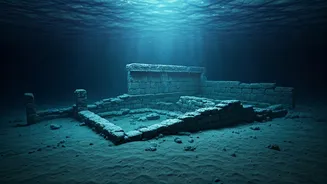
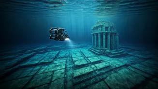
Confirming the Finds Up Close
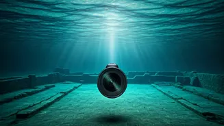
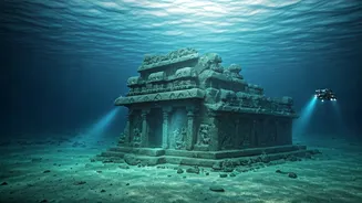
Once sonar mapping identifies a potential site, the next step is visual confirmation. In earlier explorations, this meant sending down teams of professional divers to photograph, measure, and document the ruins firsthand. They would find and document features like walls, platforms, and scattered dressed stone blocks. More recently, the ASI's Underwater Archaeology Wing has employed Remotely Operated Vehicles (ROVs). These unmanned submersibles are equipped with high-resolution cameras and lights, allowing teams to explore deeper and more safely, capturing clear video of the submerged structures without disturbing them. This technology provides crucial visual evidence to confirm that the sonar anomalies are indeed the remnants of an ancient architectural complex.
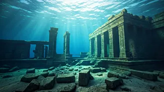
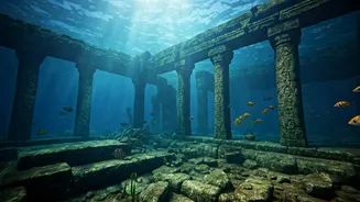
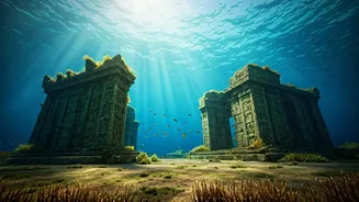
What Have They Actually Found?
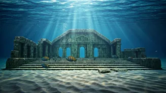
These systematic explorations have confirmed that the legends are based in fact. Joint missions by the NIO and ASI have identified significant man-made structures submerged at depths of 5 to 8 meters, located up to 800 meters from the current shoreline. Discoveries include walls over 10 meters long, flights of stairs, chiseled stone blocks, and foundation platforms consistent with temple architecture. Some explorations even uncovered structures with features suggesting they belong to the Pallava era, and potentially even earlier periods. While the finds may not perfectly match the legend of six complete temples, they provide undeniable evidence of a large, submerged building complex, confirming that the ancient city of Mahabalipuram was once much larger than what stands on the shore today.