






Understanding AI's Limitations
AI tools like ChatGPT or Gemini are language models, not seasoned mountaineers. They confidently assemble information from the internet, but they don't understand terrain, risk, or real-time conditions. Search and rescue teams report a rise in incidents
where hikers, relying on AI-generated advice, found themselves in trouble. These tools can 'hallucinate' non-existent trails, drastically underestimate hiking times, or fail to mention life-or-death details like seasonal snowpack or the need for specific gear. One rescue team noted a group was advised an 8-hour hike would suffice for a route that typically takes 11 to 15 hours. The AI gives a plausible-sounding answer, but it lacks the critical judgment that keeps hikers safe.
Cross-Reference with Official Sources
The single most important step is to treat AI-generated information as a starting point, not a final answer. Always verify its suggestions with official and authoritative sources. For any given trail, this means checking the website of the park service (like the U.S. Forest Service) or the land manager responsible for the area. These sites provide the most accurate, up-to-date information on official trail status, closures, permits, and safety alerts. Rangers explicitly advise hikers to call or visit a ranger station to get information from a real person with firsthand knowledge of the mountain's current state.
Consult Recent, Human-Generated Trip Reports
While an AI pulls from a vast, static library of data, hikers on the trail yesterday have the freshest intelligence. Use apps like AllTrails, onX, or Wikiloc to read recent trip reports from other people. These reports provide crucial, time-sensitive details an AI cannot: Is the water source still flowing? Are there downed trees blocking the path? Is the trail unexpectedly muddy or icy? This human-generated feedback loop is an invaluable reality check. Look for patterns in recent comments to build a reliable picture of the trail's current condition. While some apps are trying to use AI to predict conditions, they still often rely on user-reported data as a baseline.
Don't Ditch the Map and Compass
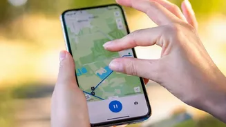
Digital navigation is a fantastic tool, but it should never be your only tool. Poor navigation accounts for over a third of mountain rescue callouts, often due to over-reliance on phone apps. Batteries die, especially in the cold, and phones can break or lose signal. Before any hike, especially one in a new area, you should have a physical, waterproof map and a compass. More importantly, you need to know how to use them. Practice with them on familiar trails so that if your digital tools fail, you can orient yourself and navigate to safety using landmarks and terrain association. A dedicated GPS unit offers a more robust backup than a phone, but even that is no substitute for foundational skills.
Verify Weather and Seasonal Conditions
AI models are notoriously poor at providing real-time, location-specific weather. They might pull a general forecast but will miss microclimates and the rapid changes common in mountain environments. A trail that is perfectly safe in summer can be a dangerous mountaineering route in spring, covered in snow and ice. Always check multiple, reliable weather sources specifically for the elevation you'll be hiking at. Look for forecasts from meteorological services and check for any active weather advisories. Apps like AllTrails+ are beginning to integrate more dynamic weather, snow depth, and air quality overlays, which can be useful but should still be verified.
Use AI as a Planner, Not a Navigator
The safest way to use AI is for the initial planning phase. Use it to generate ideas, compare potential routes, or create a packing checklist. For example, you can ask it to create a comparison table of two different trails, outlining their distance, elevation gain, and reported difficulty. But every piece of critical data it provides—trailheads, water sources, timings, and especially the route itself—must be rigorously fact-checked against the sources mentioned above. Think of it as an intelligent assistant that can speed up your research, but you are the expedition leader who holds final responsibility for every decision.