






A Constant Watch from 36,000 Kilometres
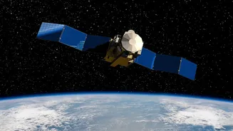
Imagine a satellite that doesn’t just pass over India a few times a day, but stays parked in the sky, watching over the entire subcontinent continuously. That is the core idea behind EOS-05, also known as GISAT-1A. Unlike conventional Earth observation
satellites that circle the planet in Low Earth Orbit (LEO), EOS-05 operates from a geosynchronous orbit, roughly 36,000 kilometres high. At this altitude, its orbital period matches the Earth's rotation, allowing it to remain seemingly fixed over one region. This unique positioning is what makes it a potential game-changer. Instead of getting periodic snapshots, ISRO can now get a near-constant stream of data, transforming how the country monitors its land and weather.
A Game-Changer for Disaster Warnings
For a nation that frequently faces the wrath of nature, the most significant promise of EOS-05 lies in disaster management. The satellite is designed to image the entire Indian landmass approximately every 30 minutes, and can zoom in on specific areas of interest for a fresh look every five minutes. This high-frequency imaging is invaluable for tracking rapidly developing events. Think of a cyclone forming over the Bay of Bengal; EOS-05 could monitor its development and path with a persistence that was previously impossible, leading to more accurate and timely warnings. Similarly, during floods, it can provide a real-time view of the extent of inundation, helping authorities direct rescue and relief efforts more effectively. The same applies to detecting forest fires in their early stages or monitoring cloudbursts in vulnerable Himalayan regions.
Redemption and a Return to Flight
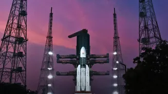
The successful launch of EOS-05 on September 4, 2026, was a story of redemption for ISRO. An earlier, similar satellite designated EOS-03 (or GISAT-1) was lost during a launch failure in August 2021 when the GSLV rocket's cryogenic upper stage failed to ignite. After years of work and a series of unrelated launch setbacks in 2025 and early 2026, the successful flight of the GSLV-F17 carrying EOS-05 marked a crucial milestone. It was not only ISRO's first successful launch of 2026 but also a powerful demonstration of the agency's resilience and restored confidence in the GSLV rocket. This success finally delivered the capability that India had been working towards for years.
More Than Just Weather
While its role in disaster management is paramount, the capabilities of EOS-05 extend much further. The satellite is equipped with multi-spectral and hyperspectral cameras, allowing it to see across various wavelengths of light, not just the visible spectrum. This technology unlocks a wide range of applications. In agriculture, it can be used for crop health monitoring and yield estimation. It can also monitor water bodies, track the melting of glaciers in the Himalayas for better water resource management, and observe changes in forest cover. Furthermore, this 'eye in the sky' has significant strategic applications, offering persistent surveillance over India's land and maritime borders to enhance national security.