




A Landmark India-US Partnership
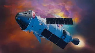
The mission, known as NISAR (NASA-ISRO Synthetic Aperture Radar), is a testament to international collaboration in science. Launched in July 2025, it is one of the most sophisticated Earth-observation satellites ever built. ISRO provided the S-band radar
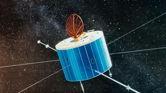
system and the powerful GSLV launch vehicle, while NASA contributed the L-band radar and the massive 12-metre reflector antenna—the largest of its kind ever sent to space. Together, these instruments provide an unprecedented, all-weather view of our planet, collecting data day and night, regardless of cloud cover. The data from this mission is shared openly, allowing scientists worldwide to track changes across Earth's surface.
Seeing Without Light: The Magic of Radar
Unlike standard optical satellites that work like cameras, NISAR operates on a different principle. It uses Synthetic Aperture Radar (SAR), which actively sends microwave pulses towards the Earth and analyses the signals that bounce back. This technology isn't dependent on sunlight, allowing it to work in complete darkness. More importantly, the radar waves can penetrate clouds, smoke, and even the top layers of snow and ice. This gives scientists a look beneath the surface, revealing hidden structures and movements. By analysing how the radar waves scatter, researchers can determine the texture, composition, and movement of the surface with astonishing precision, detecting changes as small as a centimetre.
Unveiling a Hidden Continent
Nowhere is NISAR's unique ability more valuable than in Antarctica. Recent images released by the mission have offered a stunning new perspective on the frozen continent. While an optical satellite sees a vast, white expanse, NISAR's radar reveals the world beneath. A now-famous image of a feature named Nunatak Zaterjavshijsja shows a rocky mountaintop poking through the ice. As the glacier flows around this obstacle, the ice fractures into a complex network of deep cracks, or crevasses. In the false-colour radar image, these crevasses appear as sharp green lines, creating a pattern that scientists nicknamed "the hummingbird." This imagery provides crucial insights into how glaciers move and fracture, information that was previously invisible from space.
Why Monitoring Antarctica Matters
These detailed observations are far more than just beautiful pictures. The Antarctic ice sheet holds about two-thirds of all the freshwater on Earth. As the planet warms, this ice is melting at an accelerating rate, contributing significantly to global sea-level rise. Data shows Antarctica has been losing about 150 billion tonnes of ice per year since 2002. Satellites are the only practical way to monitor such a vast and remote region. By tracking ice velocity, thinning, and the break-up of ice shelves, missions like NISAR provide the critical data needed for climate models. These models help predict the future of sea-level rise, a vital concern for coastal communities around the world, including India's extensive coastline.
A New Era of Earth Observation
With its ability to scan nearly all of Earth's land and ice surfaces every 12 days, NISAR is building a long-term, consistent record of our changing planet. The mission's data, which became publicly available in July 2026, is helping scientists monitor not just ice sheets, but also earthquakes, landslides, volcanic activity, and changes in forests and agriculture. For India, this partnership represents a major milestone in its space program, placing ISRO at the forefront of critical climate research. The insights gained from NISAR will be invaluable for managing natural disasters, securing water resources, and preparing for the long-term impacts of a warming world.