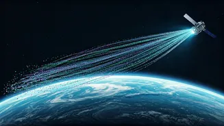


What Exactly Is 'Space Data'?
When we say 'space data,' it's easy to think of astronauts or stunning images of distant galaxies. In the context of climate tech, however, it refers to something far more practical: Earth Observation (EO) data. This is a vast and continuous stream of information
captured by satellites orbiting our planet. These are not just simple photographs. Satellites are equipped with advanced sensors that can 'see' across different spectrums, like infrared and microwave radar. This allows them to measure a huge range of variables, from ground temperature and soil moisture to the chemical composition of the atmosphere and the precise height of the ocean. This data provides an objective, large-scale view of our planet's health, turning the entire globe into a system that can be monitored and measured in near real-time. It’s the ultimate dataset for understanding environmental change.
Connecting Satellites to Climate Solutions
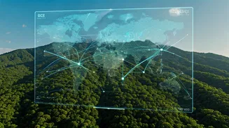
So how does this translate into real-world climate action? The applications are transformative. In agriculture, satellite data helps create 'precision agriculture' solutions, analysing soil quality and crop health to optimize irrigation and fertilizer use, boosting yields while saving resources. For disaster management, it's a game-changer. Authorities can use satellite imagery to monitor floodplains, track the path of cyclones, and identify areas at high risk of landslides—sometimes with enough warning to take proactive measures. Furthermore, this data is crucial for conservation. We can track deforestation in remote forests, monitor the melting of Himalayan glaciers, measure the carbon stored in our ecosystems, and even spot illegal mining operations. More than half of all critical climate variables can only be effectively observed from space, making this data indispensable for governments and companies working to meet sustainability goals.
The Indian Climate-Tech Opportunity
For students in India, this global trend has enormous local relevance. The Indian Space Research Organisation (ISRO) is a major player in Earth Observation. Through portals like Bhuvan and Bhoonidhi, ISRO makes a vast amount of geospatial data freely available. This data is already being used to forecast crop production, manage water resources, and support disaster relief efforts across the country. The future is even more exciting. The upcoming NISAR mission—a joint project between NASA and ISRO—is set to be the world's most expensive Earth-observation satellite. It will use advanced dual-frequency radar to provide incredibly detailed insights into changes in India’s forests, coastlines, and agricultural lands, with a unique ability to see through clouds and tree cover. As India's downstream space-tech sector grows, companies are increasingly building innovative solutions on top of this data, creating a surge in demand for skilled professionals.
Why This Matters for Your Career
This is where you come in. As climate-tech becomes more data-driven, there is a growing skills gap. Companies need people who can do more than just understand climate science; they need professionals who can source, interpret, and analyse large geospatial datasets to derive actionable insights. Job roles like 'Geospatial Data Analyst,' 'Remote Sensing Specialist,' and 'Geospatial AI Engineer' are becoming common in the climate sector, often commanding high salaries. These are not just roles for traditional geographers. Whether your background is in computer science, engineering, data science, agriculture, or public policy, adding geospatial data skills to your CV can provide a significant career advantage. It demonstrates a capacity for interdisciplinary thinking and a forward-looking approach to problem-solving that is highly valued by employers in this innovative field.
How You Can Get Started Today
The best part is that you don't need access to a billion-dollar space program to begin. A wealth of data and tools are available online for free. You can start by exploring ISRO's Bhuvan geoportal to see what data is available for India. For global datasets, NASA's Earthdata Search and the European Space Agency's Copernicus Open Access Hub are essential resources. These platforms allow you to browse and download satellite imagery and data products. To actually analyse this data, cloud platforms like Google Earth Engine provide the processing power and tools for free, allowing you to run complex analyses without needing a supercomputer. There are numerous tutorials and online courses available that can guide you through the basics of remote sensing and geospatial analysis. By starting to explore these resources now, you can build a foundational skill set that will make you an invaluable asset to the future of climate tech.