




Eyes in the Sky: India's Space Guardians
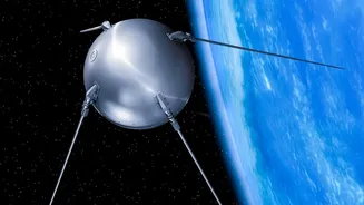
India, through the Indian Space Research Organisation (ISRO), operates a sophisticated fleet of satellites that form the backbone of its earth observation capabilities. Key among these are the Indian Remote Sensing (IRS) satellites, including the Resourcesat
and RISAT (Radar Imaging Satellite) series, and the geostationary INSAT (Indian National Satellite System) series. These satellites are equipped with advanced sensors that can see far more than the human eye. They capture images across different wavelengths of light, allowing scientists to analyse everything from plant health to water levels with remarkable precision. The RISAT series is particularly crucial as its radar can see through clouds and darkness, making it invaluable for monitoring during the monsoon season when floods and cyclones are most common.
Revolutionising the Farm
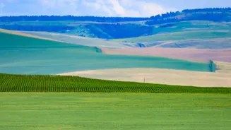
For a nation where agriculture is a cornerstone of the economy, timely and accurate information about crops is vital. This is where programmes like FASAL (Forecasting Agricultural output using Space, Agro-meteorology and Land-based observations) come into play. Run by the Mahalanobis National Crop Forecast Centre (MNCFC), FASAL uses satellite imagery to provide pre-harvest production forecasts for major crops like rice, wheat, and cotton. The satellites monitor the total area under cultivation and assess crop health using metrics like the Normalised Difference Vegetation Index (NDVI), which indicates photosynthetic activity. This data helps the government make informed decisions about food security, pricing, and procurement. It also assists in schemes like the Pradhan Mantri Fasal Bima Yojana (PMFBY) for crop insurance by providing transparent, data-backed assessments of damage due to natural calamities.
A Lifeline During Floods
Floods are a recurring and devastating reality in many parts of India. Satellite technology provides a crucial advantage in managing these disasters. When heavy rains are predicted, satellites monitor river levels and soil moisture. During a flood, near real-time imagery helps create inundation maps, showing precisely which areas are underwater. This information is indispensable for disaster response teams, enabling them to prioritise rescue efforts, locate stranded people, and plan relief operations effectively. Organisations like the National Remote Sensing Centre (NRSC) provide these vital inputs to disaster management authorities. The ability of satellites to map vast, inaccessible areas quickly makes them a far superior tool compared to ground-based surveys alone, allowing for faster and more efficient crisis management.
Tracking the Storm: Cyclone Warnings
The Indian subcontinent is highly vulnerable to cyclones forming in the Bay of Bengal and the Arabian Sea. The India Meteorological Department (IMD) maintains a constant watch over these waters using geostationary satellites like INSAT. These satellites provide continuous images, allowing meteorologists to detect the formation of low-pressure systems that could intensify into cyclones. They track the storm's movement, estimate its intensity by analysing cloud patterns and temperature, and predict its path and landfall. This continuous monitoring provides critical lead time for authorities to issue warnings and carry out large-scale evacuations, a process that has drastically reduced the loss of life from cyclones in recent decades. The combination of satellite data, Doppler radar, and advanced prediction models forms a robust early warning system that has proven its worth time and again.