



Seeing Through Clouds and Darkness
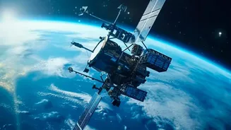
Before diving into the training, let's understand what makes SAR so special. Unlike the satellite pictures you see on a weather app, which are essentially photographs from space (optical imagery), SAR is an active imaging technology. It sends out its
own radar pulses and records the echoes that bounce back from Earth's surface. This fundamental difference gives it superpowers: it can 'see' through clouds, rain, and fog, and it works just as well at night as it does during the day. This all-weather, day-and-night capability is crucial for continuous monitoring of our planet, especially during emergencies like floods or cyclones when optical satellites are often blinded by cloud cover.
ISRO's Free Learning Initiative
The Indian Space Research Organisation (ISRO), through its premier Indian Institute of Remote Sensing (IIRS), regularly offers free online courses to students, researchers, and professionals. These outreach programs aim to build capacity in geospatial technologies. The courses on SAR data processing are part of this initiative, designed to be accessible to a wide audience, including undergraduate and postgraduate students. Delivered through a live and interactive online platform, these courses are taught by ISRO's own experts. The goal is to equip the next generation with the skills needed to utilize data from India's own radar imaging satellites, like the RISAT series, and upcoming missions like NISAR (a joint NASA-ISRO project).
Core Skills Students Will Gain
The training goes beyond just looking at pretty pictures. Students learn the entire workflow of SAR data analysis. This starts with understanding the basics of radar remote sensing and digital image processing. A key skill is learning how to process raw SAR data, which is notoriously complex and noisy (a phenomenon called 'speckle'). Participants get hands-on experience, often using open-source software, to perform essential corrections and analysis. They learn to interpret what the different signals and textures in a SAR image mean—for example, how to distinguish between a flooded area, a dense forest, and an urban settlement based on how the radar signal interacts with them. This involves gaining proficiency in techniques like image classification, segmentation, and change detection.
Solving Real-World Problems
Perhaps the most exciting part of the training is learning how to apply these skills to solve real-world problems affecting India. One of the most significant applications is in disaster management. Students can learn to map the extent of floods in near real-time, identify areas vulnerable to landslides, and assess damage after earthquakes. In agriculture, SAR data is invaluable for monitoring crop health, assessing soil moisture, and estimating biomass, which can lead to more efficient farming. Other applications include monitoring deforestation, tracking urban sprawl, observing the movement of glaciers in the Himalayas, and keeping an eye on our coastlines. This training connects abstract data analysis with tangible, impactful outcomes.
A Launchpad for Future Careers
For students, acquiring skills in SAR analysis is a strategic career move. Proficiency in geospatial technology is a rapidly growing field with increasing demand for trained manpower. This training provides a strong foundation for careers in remote sensing, Geographic Information Systems (GIS), and environmental science. Graduates can find opportunities in government agencies involved in disaster management, natural resource planning, and defence. They are also sought after by private companies in sectors like agriculture technology, infrastructure planning, and environmental consulting. For those with a passion for space, this expertise is a direct stepping stone towards a career in space science and technology, working with cutting-edge satellite data to push the boundaries of our knowledge about Earth.