




The Primary Set of Eyes
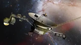
The star of the show for visible imaging is the Europa Imaging System, aptly nicknamed EIS (and pronounced “ice”). This isn't just one camera, but a powerful duo designed to work in tandem. It consists of a Wide-Angle Camera (WAC) and a Narrow-Angle Camera (NAC).
Think of it like having both a panoramic landscape lens and a powerful zoom lens at your disposal. Both cameras are equipped with advanced 8-megapixel sensors that can capture images in vibrant color and even in stereo, which allows scientists to create three-dimensional maps of the surface. These 3D views are essential for measuring the height of ridges and the depth of canyons, providing crucial clues about the geologic forces that have shaped this icy world.
A Leap in Resolution
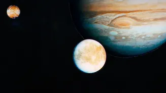
Previous missions, like Galileo in the 1990s, gave us our first tantalizing close-ups of Europa, but Clipper's EIS is in a different league entirely. The system is designed to map approximately 90% of the moon’s surface at a resolution of 100 meters per pixel, a massive upgrade in coverage and detail. But during its closest flybys, when the spacecraft swoops just 25 kilometers above the ice, the Narrow-Angle Camera will achieve a breathtaking resolution of 0.5 meters per pixel. To put that in perspective, it would be like being able to spot an object the size of a small suitcase on the ground from an airplane. This incredible detail will allow scientists to scrutinize the patterns of fractures, search for signs of recent geologic activity, and potentially spot evidence of plumes erupting from below the surface.
Seeing What's Beneath the Surface
Capturing surface images is only half the story. The headline feature of Europa is its suspected subsurface ocean, hidden beneath miles of ice. To investigate this, Clipper carries an instrument that doesn't use visible light at all: the Radar for Europa Assessment and Sounding: Ocean to Near-surface, or REASON. It's the only instrument on the spacecraft that can look directly into the ice shell. REASON works by sending out radio waves at two different frequencies. These waves penetrate the ice and bounce off any changes in material, such as pockets of water or the boundary between the ice and the deep ocean below. By measuring the return signals, scientists can create a 3D map of the ice's internal structure, determine its thickness, and search for the liquid water that makes Europa so compelling.
Building a Complete Picture
To complement the visual and radar data, other instruments help build a comprehensive understanding. The Europa Thermal Emission Imaging System (E-THEMIS) acts as a heat detector, scanning the surface in infrared to find warm spots that could indicate recent eruptions or areas where the ocean is close to the surface. Meanwhile, the Mapping Imaging Spectrometer for Europa (MISE) analyzes the chemical makeup of the surface. By breaking down the reflected light, it can identify the distribution of different ices, salts, and even organic compounds. When combined, the data from EIS, REASON, E-THEMIS, and MISE will give scientists an unprecedentedly detailed portrait of Europa. The high-resolution images will provide the visual context for the chemical data and the structures revealed by the ice-penetrating radar.