




Demystifying SAR: A Weather-Proof Vision
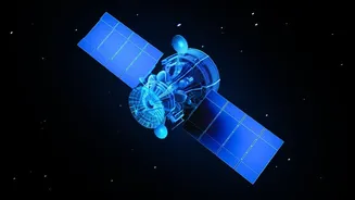
Synthetic Aperture Radar, or SAR, is a powerful form of remote sensing that offers a significant advantage over traditional optical satellites. Unlike cameras that depend on light, SAR systems actively send out microwave pulses and interpret the signals
that bounce back. This allows them to create detailed images of the Earth's surface regardless of weather conditions or time of day. Whether it’s penetrating the dense cloud cover of a monsoon, the smoke from a forest fire, or the darkness of night, SAR provides a reliable and consistent eye in the sky. This all-weather capability makes it an indispensable tool for a country with as diverse and dynamic a climate as India.
Why SAR Analysis is a Critical Skill in India
The demand for SAR expertise in India is growing, driven by national priorities. The technology is vital for disaster management, enabling authorities to map flood inundation, assess earthquake damage, and monitor landslides in near real-time. In agriculture, SAR data helps in monitoring crop health, assessing soil moisture, and forecasting yields, which is crucial for the nation's food security. Furthermore, with the landmark NASA-ISRO SAR (NISAR) mission on the horizon, the volume and quality of available data are set to explode. The NISAR satellite will scan nearly all of Earth's land and ice surfaces twice every 12 days, providing an unprecedented stream of data for studying climate change, natural hazards, and ecosystems. This initiative signals a massive opportunity and a growing need for trained professionals who can turn this data into actionable insights.
Premier Indian Institutions for SAR Training
For students looking to build a career in this field, India offers several excellent starting points. The premier institution is the Indian Institute of Remote Sensing (IIRS) in Dehradun, a constituent centre of the Indian Space Research Organisation (ISRO). IIRS regularly conducts a range of training programmes, from short-term online courses to postgraduate-level education in remote sensing and geo-informatics. These courses are designed for students, researchers, and working professionals. Beyond IIRS, many Indian Institutes of Technology (IITs), such as IIT Roorkee and IIT Bombay, have strong geoinformatics and remote sensing departments that incorporate SAR analysis into their curriculum. Students pursuing degrees in civil engineering, earth sciences, or computer science at these top institutions often have opportunities to specialise in geospatial technologies.
Accessible Learning Through Online Courses
For those unable to enrol in full-time programmes, the digital classroom offers a wealth of resources. ISRO, through its IIRS centre, frequently provides free online courses and webinars on various aspects of remote sensing, including SAR data processing. These programmes often come with a certificate upon completion and are open to a wide audience, from undergraduate students to government officials. Global platforms like Coursera and edX also host courses on remote sensing and digital image processing from international universities. Additionally, the European Space Agency (ESA) provides free-to-access radar courses and tutorials that use data from its own satellite missions, which can be an excellent way to get hands-on experience with open-source data and software.
Building a Career in Geospatial Analysis
Learning SAR image analysis opens doors to a variety of impactful careers. Professionals with these skills are sought after in government organisations like ISRO, the National Remote Sensing Centre (NRSC), and various disaster management authorities. They also find roles in the private sector, working in agriculture technology, infrastructure monitoring, environmental consulting, and defence intelligence. Aspiring SAR analysts should aim to build a complementary skill set that includes proficiency in Geographic Information Systems (GIS) software, programming languages like Python for data automation, and fundamentals of machine learning to analyse large datasets. As India continues to leverage space technology for national development, the role of the SAR analyst will only become more critical.