


The Annual Waterlogging Crisis
For residents of India's Silicon Valley, the monsoon season often brings a sense of dread. What should be a welcome respite from the heat quickly morphs into a civic nightmare. Key arterial roads turn into impassable rivers, basements fill with murky
water, and daily life grinds to a halt. The reasons are well-documented: rapid, often unplanned urbanisation, the paving over of porous surfaces, and most critically, the systematic encroachment and clogging of the city's intricate network of stormwater drains, or *rajakaluves*. For years, the cycle of blame was as predictable as the rains themselves, with citizens pointing fingers at the Bruhat Bengaluru Mahanagara Palike (BBMP) and authorities citing unprecedented rainfall. But that narrative is finally changing.
From Passive Complaints to Proactive Mapping
Frustrated by the recurring cycle of disaster and inaction, several community groups across the city decided to move beyond social media outrage. Groups like Bellandur Jothege, Whitefield Rising, and Citizens for Bengaluru began organising themselves to tackle the problem at its source. Their logic was simple: if the authorities lacked the granular data to identify and fix every single blockage, then the citizens who live with these problems every day would create that data themselves. This marked a fundamental shift from being passive victims of urban decay to becoming active custodians of their neighbourhoods. They realised that to demand accountability, they first needed to provide irrefutable evidence.
The Anatomy of a Choke Point
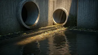
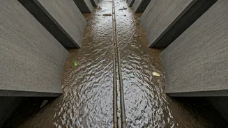
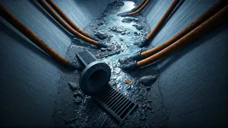
So, what exactly are they mapping? These volunteers are identifying 'choke points'—specific locations where the city's drainage system fails. A choke point could be a drain deliberately blocked by illegal construction, a culvert stuffed with plastic waste and construction debris, or a section of a *rajakaluve* that has been narrowed or built over, preventing the free flow of water. The process is a blend of old-school legwork and modern technology. Volunteers walk the length of drains in their localities, armed with smartphones. They take geo-tagged photographs and detailed notes of every obstruction, dumping spot, and encroachment they find. This isn't a casual weekend activity; it's a systematic, data-driven survey aimed at creating a comprehensive, block-by-block audit of the city's drainage health.
Citizen Science Powered by Tech
This movement is far from amateur. The collected data is meticulously organised and visualised using Geographic Information System (GIS) tools, creating detailed maps that pinpoint exact failure points. These maps are often made public, transforming anecdotal complaints into a powerful visual database of civic negligence. Some groups develop their own simple apps for data collection to ensure uniformity. By leveraging accessible technology, these residents are essentially conducting a city-scale diagnostic. The resulting reports are not just a list of grievances; they are professional-grade documents that can be presented to BBMP officials, engineers, and elected representatives, leaving little room for ambiguity or denial.
Bridging the Gap with Civic Bodies
The relationship between these citizen groups and the BBMP is complex but evolving. Initially met with scepticism, the high quality and sheer volume of data have forced the authorities to take notice. In some wards, a collaborative model has emerged, with engineers using the citizen-provided maps to guide desilting and clearing operations. The data acts as a priority list, helping the under-resourced municipal body direct its efforts more effectively. In other cases, the maps become a tool for accountability, used in public forums and media reports to pressure officials into action. Either way, the citizens are no longer just petitioners; they are information partners, changing the power dynamic between the governed and the government.
Are the Floods Being Defeated?
While it's too early to declare a final victory over urban flooding, the impact of these initiatives is undeniable. In several mapped localities, residents have reported reduced waterlogging after targeted clearing operations based on their data. Illegal dumping has decreased in areas under constant citizen watch. More importantly, this movement has created a scalable model for civic engagement. While Bengaluru's flood problem is far from solved, these community groups are proving that a determined, organised, and data-backed citizenry is the most powerful tool in the fight for a more functional and resilient city. They are not just mapping drains; they are charting a new path for urban governance in India.