






A New Guardian in the Sky
The Indian Space Research Organisation (ISRO) has bolstered its earth observation capabilities with a sophisticated suite of satellite systems designed to monitor our oceans with unprecedented detail. A key component of this enhanced network is the recently
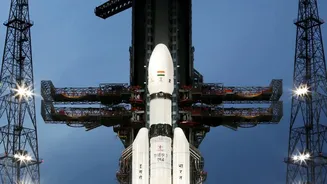
launched NASA-ISRO Synthetic Aperture Radar (NISAR) satellite. This joint mission, launched in 2025, is a significant leap forward. Unlike older satellites, NISAR uses advanced radar to scan the Earth's surface every 12 days, providing a constant stream of high-quality data. This system joins ISRO's existing fleet of ocean-monitoring satellites like Oceansat and SCATSAT-1, which already provide crucial data on ocean surface winds and sea state. The new radar technology, however, provides a much sharper and more reliable picture, fundamentally changing the game for coastal monitoring.
The Power of All-Weather Vision
So, what makes this radar so special? The primary advantage of Synthetic Aperture Radar (SAR) is its ability to see through clouds, fog, and even darkness. This is a critical capability, as cyclones and severe storms are, by nature, cloaked in dense cloud cover that can blind conventional optical satellites. The radar onboard NISAR can penetrate this cover, giving scientists and forecasters a clear view of the sea surface conditions beneath. It can detect changes in the ocean surface with remarkable precision, measuring wave heights, wind speeds, and the subtle shifts that signal a developing storm. This all-weather, day-and-night capability means there are no blind spots in our watch over the seas, ensuring continuous monitoring when it is needed most.
From Data to Life-Saving Alerts
Collecting data is only the first step. The real magic happens when this information is translated into actionable warnings. ISRO's ground centres, like the National Remote Sensing Centre (NRSC), process terabytes of satellite data to identify threats. Observations on surface winds from scatterometers can provide a clear warning of a potential cyclone up to four days in advance. By combining this with high-resolution radar imagery, models can more accurately predict a cyclone’s track, its intensity, and, crucially, the potential for storm surges—the abnormal rise in sea level that causes the most devastation during a cyclone. ISRO is also leveraging AI to analyse satellite imagery and other data points to detect hazards like dangerous rip currents in real time, transforming environmental data into insights that can reduce risks along the coast.
Protecting Lives and Livelihoods
For the millions of Indians living and working along the coast, this technological advancement has a very human impact. Fishermen receive more accurate and timely warnings about rough seas, helping them avoid venturing out into danger. Disaster management agencies get a clearer, more reliable picture of an approaching storm, allowing for more effective evacuation planning and resource deployment. The data also provides invaluable insights into coastal erosion, a slow-moving disaster that affects a significant portion of India's shoreline. Studies have shown that about a third of India's coast is vulnerable to erosion. By precisely mapping changes in the coastline, NISAR can help authorities plan better coastal protection measures, safeguarding homes, infrastructure, and fragile ecosystems like mangroves.
Beyond Safety: Economic and Strategic Gains
The benefits of this enhanced surveillance extend beyond disaster management. High-resolution ocean data is a boon for the 'blue economy'. It aids in identifying potential fishing zones, making the fishing industry more efficient and sustainable. It helps in planning safer and more efficient shipping routes, and it is vital for the management of coastal resources. Furthermore, this capability strengthens India's maritime domain awareness, providing a strategic eye over the Indian Ocean region. The ability to monitor the vast expanse of the ocean contributes not only to civilian safety but also to national security. The data gathered will support everything from environmental monitoring and climate change research to urban planning for coastal cities, making it a truly multi-purpose national asset.