





The Unseen Shield Under Threat
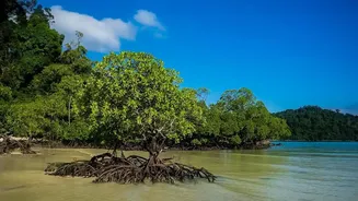
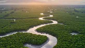
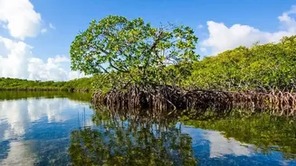
The Sundarbans, the world's largest mangrove forest, is more than just a UNESCO World Heritage site; it is a living bulwark for millions in coastal West Bengal and Bangladesh. When cyclones barrel in from the Bay of Bengal, this intricate ecosystem acts
as a natural shock absorber. The dense network of trees can reduce the devastating power of wind and storm surges, dissipating wave energy and slowing water flow. However, this vital shield is facing a double-edged threat. Climate change is fueling more frequent and intense cyclones, while rising sea levels and increasing salinity are stressing the mangroves from within, affecting their health and density. Studies show that while the overall area of the forest has remained relatively stable, the health of many trees is declining, making them less resilient.
An Eye in the Sky Watches Over
Understanding the exact condition of this vast, often impenetrable forest is a monumental task. This is where satellite technology comes in. For decades, researchers have relied on orbiting satellites like the Landsat series and the Copernicus Sentinels to monitor the Sundarbans. These platforms provide a continuous stream of high-resolution imagery, allowing scientists to see the forest in ways impossible from the ground. They capture data across different light spectrums, revealing details invisible to the naked eye. By comparing images taken before and after major storms like Cyclone Amphan, researchers can precisely map areas of damage, including tree loss and coastal erosion. This technology provides a comprehensive, landscape-scale view, crucial for assessing both sudden damage and slow, long-term changes.
From Pixels to a Plan for Protection
The raw satellite data is just the beginning. Scientists use sophisticated techniques to turn these pixels into actionable intelligence. One key tool is the Normalised Difference Vegetation Index (NDVI), a method that measures the greenness and density of plant life. A high NDVI value indicates a healthy, thriving mangrove canopy, while a low or declining value can signal stress, disease, or degradation. By tracking NDVI over months and years, researchers can pinpoint areas where the forest's defensive capabilities might be weakening. Other methods involve using radar to penetrate cloud cover and map changes in water levels and land elevation, creating detailed models of how a storm surge might inundate the low-lying islands. Machine learning algorithms are increasingly used to process this vast amount of data, identifying patterns and predicting future vulnerabilities with greater accuracy.
Revealing the Coastline’s Secrets
This high-tech monitoring has yielded critical insights. Research has shown that the shape and history of the coastline play a huge role in its vulnerability. Shorelines that have been eroding over decades are far more susceptible to damage during a cyclone. Satellite analysis after Cyclone Amphan in 2020 revealed that shorter mangrove stands, which cover about 40% of the Sundarbans, were more widely damaged than taller trees. Furthermore, data shows that repeated cyclones are slowing the forest's natural ability to recover, altering its composition over time. These findings help identify specific 'hotspots' of vulnerability—areas like Sagar, Namkhana, and Patharpratima—that require urgent attention and targeted intervention. This detailed mapping helps move beyond a one-size-fits-all approach to conservation.
A Race Against the Rising Tide
The knowledge gained from satellite mapping is not just academic; it is a vital tool for disaster management and climate adaptation. By identifying the weakest points in the Sundarbans' natural defenses, authorities can make informed decisions. This could mean prioritising these areas for mangrove reforestation and regeneration projects, or strengthening man-made embankments in locations where the natural buffer has been compromised. The data also feeds into more accurate storm surge models, improving early warning systems and helping authorities plan evacuation routes for the 4.5 million people living in the Indian Sundarbans. It provides the evidence needed to argue for landscape-scale management that considers sediment flow and coastal dynamics, ensuring that both nature and communities are more resilient to future storms.