




A New Eye in a Fixed Orbit
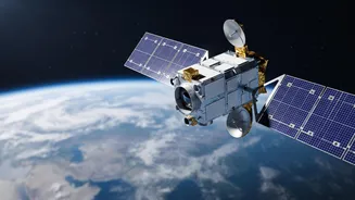
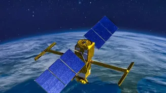
On September 4, 2026, ISRO is scheduled to launch its Earth Observation Satellite-05 (EOS-05) aboard a GSLV-F17 rocket from Sriharikota. This isn't just another satellite; it's India's first imaging satellite designed for a geostationary orbit. Most earth
observation satellites, like those in the Cartosat series, are in Low Earth Orbit (LEO), circling the globe and passing over a specific location only periodically. EOS-05, also known as GISAT-1A, will be positioned at an altitude of approximately 36,000 kilometres. At this height, its orbit will synchronise with the Earth's rotation, allowing it to seemingly 'hover' over the Indian subcontinent. This fixed gaze is what makes continuous, near real-time monitoring possible, a significant leap from the snapshots provided by lower-orbit satellites.
What 'Real-Time' Really Means
The term 'real-time' signifies a massive reduction in the time it takes to get updated imagery. Once operational, EOS-05 is expected to image the entire Indian landmass every 30 minutes. For specific areas of interest or during rapidly unfolding events, it can revisit a target every five minutes. This capability is a game-changer. Instead of waiting hours or even days for a satellite to pass over a cyclone, flood, or forest fire again, disaster management agencies can receive a steady stream of updates. This high-frequency imaging is enabled by advanced onboard instruments, including multispectral and hyperspectral sensors that can see across various light bands, providing data on everything from vegetation health to land surface temperatures.
A Game-Changer for Disaster Management
The most immediate and critical application of this new capability is in disaster management and weather forecasting. The persistent watch from a geostationary orbit will allow for the continuous tracking of cyclones as they form over the ocean, monitoring of floodwaters as they spread, and quick detection of forest fires. This constant flow of data supports faster, more informed decision-making for evacuations and relief efforts. The satellite's ability to provide wide-area monitoring supplements existing systems, offering a broader, synoptic view that is crucial during large-scale emergencies when every minute counts.
Bolstering National and Economic Security
Beyond civilian uses, a persistent eye over the region has clear strategic benefits. The satellite will enhance the monitoring of India's remote border areas and maritime assets, providing a constant vigil for both military and civilian applications. Economically, the applications are just as vast. The data collected by EOS-05 will be invaluable for agriculture, allowing for large-scale monitoring of crop health and soil conditions. It will also aid in urban planning, infrastructure monitoring, and environmental studies, such as tracking the health of glaciers and changes in forest cover.
Redemption and a Technological Leap
The launch of EOS-05 is also a story of perseverance for ISRO. This mission is effectively a successor to the GISAT-1 (also known as EOS-03) satellite, which was lost in a launch failure in August 2021 when the GSLV rocket's cryogenic upper stage failed to ignite. A successful launch of EOS-05 will not only fulfill the original mission's objectives but also validate the improvements made to the GSLV rocket, which has had four successful flights since the 2021 failure. By placing this advanced imaging satellite in geostationary orbit, India will join an elite group of nations with this powerful observational capability.