


A staggering amount of our planet's oceans remain unmapped and unexplored. This vast, hidden world is finally coming into focus, thanks to the rise of sophisticated robots that are charting the final frontier on Earth.
The Challenge of Charting the Deep
For centuries, our knowledge of the
ocean floor has been surprisingly limited. We have more detailed maps of Mars than we do of our own planet's seabed. Traditional mapping methods rely on ships using hull-mounted sonar, a process that is slow, expensive, and heavily dependent on weather conditions. This approach provides only a low-resolution glimpse, especially in deep water, leaving vast areas as mere estimations based on satellite data. As of early 2025, it was estimated that about three-quarters of the global seabed remains unmapped to modern standards, a significant knowledge gap that impacts everything from maritime safety to climate science.
Enter the AUV: An Underwater Explorer
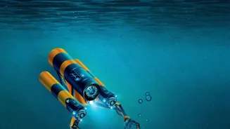
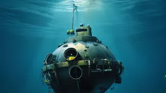
Autonomous Underwater Vehicles, or AUVs, are self-propelled, untethered robots that are changing the game. Unlike Remotely Operated Vehicles (ROVs), which are physically connected to a ship, AUVs operate independently. Researchers program a mission, deploy the vehicle, and it navigates a pre-planned route on its own, sometimes for hours or even days at a time. These vehicles are equipped with a suite of advanced sensors, cameras, and sonar systems to collect a wealth of data. After the mission, the AUV surfaces, and the data is downloaded for analysis. This autonomy makes them incredibly efficient and frees up scientists for other tasks.
A Revolution in Resolution and Safety
The key advantage of AUVs is their ability to 'fly' much closer to the seafloor than a ship on the surface, often just tens of meters above the seabed. This proximity results in dramatically higher-resolution data. AUVs are equipped with powerful mapping tools like multibeam echosounders and synthetic aperture sonar (SAS), which create detailed 3D maps and images of the underwater landscape with remarkable accuracy. Furthermore, using AUVs significantly enhances safety. By sending robots into deep, hazardous, or unpredictable waters, the need for human divers in high-risk environments is eliminated. They can operate in rough seas that would sideline a traditional survey vessel, increasing operational windows and reducing downtime.
Unlocking New Industrial and Scientific Frontiers
The high-quality maps generated by AUVs are not just for scientific curiosity; they are crucial for a growing number of industries. Detailed seabed knowledge is essential for the safe installation of offshore wind farms, subsea telecommunications cables, and energy pipelines. The oil and gas sector uses AUVs extensively for exploration and infrastructure inspection. These vehicles are also opening up new possibilities in underwater archaeology, allowing for non-invasive surveys of sunken historical sites. Recent missions have even used new AUVs to explore for critical minerals and polymetallic nodules in the deepest parts of the ocean, like the Mariana Trench region.
The Future is Autonomous
While challenges like battery life and real-time data transmission remain, the technology is rapidly evolving. The integration of artificial intelligence and machine learning is making AUVs even smarter, enabling them to identify geological features or man-made objects automatically. Global initiatives like the Seabed 2030 project, which aims to produce a definitive map of the entire ocean floor, rely heavily on the continued advancement and deployment of these technologies. As AUVs become more capable and accessible, they promise to accelerate our understanding of marine ecosystems, geological hazards, and the impacts of climate change, truly transforming our relationship with the deep ocean.