







What Makes EOS-05 a Game-Changer?
The key innovation of EOS-05 lies in its orbit. Unlike most Earth observation satellites that circle the globe in Low Earth Orbit (LEO) and revisit a location every few days, EOS-05 operates from a geosynchronous orbit (GEO) approximately 36,000 kilometres
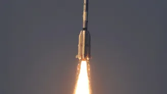
high. At this altitude, the satellite's speed matches the Earth's rotation, allowing it to seemingly 'hover' over the Indian subcontinent. This provides a persistent, unblinking eye on a vast area, a capability India has not possessed before in an imaging satellite. The mission, launched aboard a GSLV-F17 rocket, places a 2,367 kg state-of-the-art satellite that effectively replaces the unsuccessful EOS-03 mission from 2021, marking a significant comeback for ISRO's geosynchronous launch program.
A New Perspective from 36,000 Kilometres
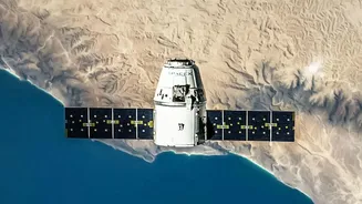
The "new perspective" offered by EOS-05 is both literal and strategic. From its high vantage point, the satellite can provide near-real-time imagery of large areas of the subcontinent. It is designed to capture an image of a selected field every five minutes and the entire Indian landmass every 30 minutes. This high frequency is invaluable. While LEO satellites provide very high-resolution images, their periodic passes mean they can miss rapidly developing events. EOS-05, on the other hand, is built for continuous monitoring, offering a constant stream of data. Its payload includes advanced multi-spectral and hyperspectral imagers, allowing it to see the Earth in various light wavelengths beyond what the human eye can perceive. This enables the identification of different crops, minerals, and environmental changes with greater accuracy.
Real-World Impact: From Farms to Floodplains
The applications for this technology are vast and transformative for both civilian and strategic sectors. For disaster management, EOS-05 is a crucial asset. It can track the development of cyclones, monitor the spread of forest fires, and provide immediate data on flood-affected regions, enabling faster and more effective rescue and relief operations. In agriculture, its frequent monitoring will help in assessing crop health, detecting pest infestations, and managing water resources more efficiently. Furthermore, the satellite will enhance environmental monitoring by observing changes in forests, water bodies, and air quality. This continuous data stream is vital for urban planning, infrastructure development, and tracking the effects of climate change across the country.
Strengthening India's Strategic Capabilities
Beyond its civilian uses, EOS-05 significantly bolsters India's strategic and security apparatus. The ability to maintain persistent surveillance over border areas and the wider Indian Ocean region provides a major advantage. While ISRO maintains that the satellite has dual-use capabilities, its persistent watch can help monitor troop movements, track ships, and secure strategic assets without the long gaps between satellite passes that previously existed. This near-continuous observation capability adds a critical layer to the nation's defence infrastructure, complementing the high-resolution 'spy' satellites already in lower orbits. The launch marks a milestone, making India part of an elite group of nations with a geostationary imaging satellite.