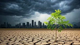


The Monsoon's Grand Blueprint
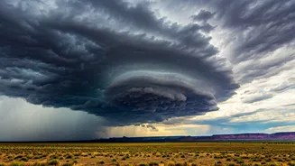
First, let's zoom out. The Indian monsoon is a massive, continent-sized weather engine. It's driven by the temperature difference between the heating landmass of India and the cooler Indian Ocean. In summer, the hot land creates a low-pressure area that
pulls in moisture-laden winds from the sea. These winds travel across the country, forming the backbone of our rainy season. This large-scale flow of moisture is the primary variable in the equation, delivering the raw ingredient for rain to every corner of the country, including its bustling cities. Without this annual system, the conversation about localised showers would be moot.
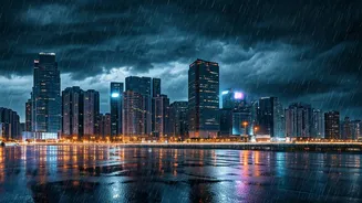
The Urban Heat Island Effect
Now, let’s add the city into the calculation. Urban areas, with their vast expanses of concrete, asphalt, and dark-roofed buildings, absorb and retain significantly more of the sun’s heat than a forest or field. This creates a phenomenon known as the “Urban Heat Island” (UHI) effect, where cities can be several degrees warmer than their surrounding rural areas. This trapped heat warms the air above the city, causing it to rise. Rising, warm, moist air is the fundamental trigger for what meteorologists call convection—the process that builds clouds and, eventually, leads to rain. In essence, the city itself provides an extra boost of energy to the atmosphere, making rain more likely.
A Dash of Pollution
Here's where the math gets even more interesting. A clean atmosphere can make it harder for rain to form. Water vapour needs a surface to condense upon to create a droplet. In the urban atmosphere, these surfaces are abundant in the form of aerosols—tiny particles of dust, smoke, and pollution from traffic and industry. While it sounds counterintuitive, these pollutants act as cloud condensation nuclei (CCN). They provide the perfect microscopic seeds around which water vapour can gather. So, a more polluted air mass, loaded with these particles, can form clouds more readily than cleaner air, adding another crucial factor that encourages rainfall directly over or downwind of urban centres.
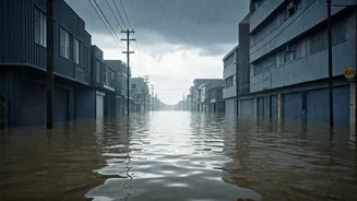
When It Rains, It Pours
When you combine these urban ingredients—the intense uplift from the heat island and the cloud-seeding effect of aerosols—the result is often not gentle, widespread drizzles, but short, intense downpours. The enhanced convection can create towering cumulonimbus clouds, the kind associated with thunderstorms. The abundance of aerosols may delay the initial onset of rain, allowing clouds to grow larger and hold more water. When the rain finally does fall, it can be released in a concentrated, high-intensity burst. This helps explain why urban floods are becoming more common; the city’s own environment contributes to creating rainfall events that are too intense for decades-old drainage systems to handle.
An Unpredictable Equation
So, the 'monsoon math' for a city isn't simple addition. It’s a complex, dynamic equation. You start with the baseline moisture provided by the monsoon. Then you add the powerful lift from the urban heat island. You multiply the effect with a high concentration of aerosols from pollution. You even have to factor in the physical shape of the city—tall buildings can alter wind patterns, creating zones of convergence where air is forced to rise, further localising storms. This is why forecasting rainfall for a specific part of a city is so challenging; the city isn't just a passive backdrop for the weather, it is an active, and often unpredictable, participant in its creation.