


A New Eye in the Sky
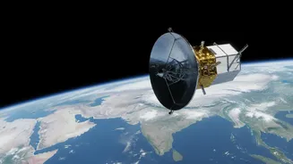
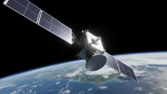
The NASA-ISRO Synthetic Aperture Radar, or NISAR, is a joint mission between the American and Indian space agencies that marks a new era in Earth observation. Launched in 2025, this sophisticated satellite is the first to use two different radar frequencies,
L-band and S-band, to systematically scan nearly the entire planet. While the headline claim of 'daily' images is an oversimplification, the reality is just as revolutionary: NISAR revisits the same spot on Earth every 12 days. This regular, predictable rhythm provides a constant flow of high-resolution data, creating a detailed, evolving map of our planet's surface, including its vast agricultural lands.
Seeing Through Clouds and Darkness
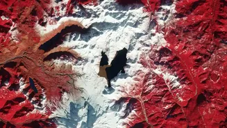
Unlike traditional optical satellites that are essentially powerful cameras, NISAR uses Synthetic Aperture Radar (SAR). Think of it less like a camera and more like a bat's echolocation. The satellite sends out microwave pulses and analyses the signals that bounce back. This technology has a massive advantage: it can see through clouds, fog, and smoke, and it works just as well at night as it does during the day. For a country like India, where the monsoon season is critical for agriculture, the ability to monitor crops regardless of cloud cover is a game-changer. It means that for the first time, policymakers and farmers can get a clear picture of crop health and soil conditions during the most vital and vulnerable part of the growing season.
From Radar Signals to Ripe Crops
So, how does a radar signal translate to crop health? NISAR's dual-frequency system is the key. The longer L-band waves can penetrate the leafy canopy of crops to measure the moisture in the soil below, while the shorter S-band waves are excellent at monitoring the structure of the vegetation itself. By analysing these signals, scientists can determine the type of crop being grown, its stage of growth, its overall health, and, most importantly, soil moisture levels with a resolution of about 100 meters. This allows for an incredibly detailed assessment, distinguishing between different crops and identifying areas of water stress or potential disease long before they might be visible to the naked eye on the ground.
A Revolution for Indian Agriculture
The implications for India are profound. With this data, agricultural bodies can generate accurate, large-scale maps of what is being planted and where. This helps in forecasting yields, managing supply chains, and formulating effective policies on everything from minimum support prices to crop insurance. For farmers, the information, once processed and disseminated through government portals like Bhoonidhi and agritech platforms, can guide crucial decisions. Knowing the precise soil moisture level can help optimise irrigation, saving water and money. Early warnings about pest attacks or nutrient deficiencies can lead to timely interventions, boosting yields and preventing losses. For disaster management, NISAR can rapidly assess damage from floods or droughts on a massive scale, enabling a faster and more targeted response.
The Challenge of the Last Mile
The satellite may generate 80 terabytes of data a day, but the true challenge lies in making this information accessible and actionable for the country's millions of farmers. Raw satellite data is complex. The success of the NISAR mission in agriculture will depend on building a robust ecosystem to process this data and deliver simple, localised advisories. This involves government agencies like ISRO and the National Remote Sensing Centre, as well as a burgeoning industry of agritech startups. The goal is to translate the satellite's sophisticated vision into practical advice that can be sent to a farmer's smartphone, empowering them to move from guesswork to data-driven decision-making and securing the future of Indian agriculture.