






What is the latest IMD forecast?
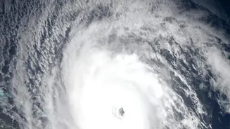
According to the India Meteorological Department (IMD), Cyclonic Storm Akvan, which formed over the central parts of the south Bay of Bengal, is intensifying as it moves north-northwestwards. As of early November 18, the storm was located approximately
610 km southeast of Machilipatnam and 610 km south-southeast of Visakhapatnam in Andhra Pradesh. The IMD predicts it will strengthen into a Severe Cyclonic Storm during the day on November 18, and further into a Very Severe Cyclonic Storm by the evening of November 19. The system has been moving very slowly, which allows it to draw more energy from the warm sea waters.
Where and when will it make landfall?
The current forecast track indicates that Cyclone Akvan is expected to cross the Andhra Pradesh coast between Nellore and Visakhapatnam. Landfall is predicted to occur around noon on November 20. At the time of landfall, the IMD anticipates it will be a Very Severe Cyclonic Storm with maximum sustained wind speeds of 120-130 kmph, gusting up to 145 kmph. Authorities are preparing for significant impact along this densely populated coastal stretch.
Which areas are on alert?
Andhra Pradesh is on high alert, with coastal districts from Nellore to Visakhapatnam, including Yanam, bracing for the main impact. Heavy to very heavy rainfall is expected in these areas from November 19, with isolated extremely heavy showers possible. The IMD has also issued an Orange Message alert for the coasts of Andhra Pradesh and adjoining south Odisha. Widespread rainfall is also predicted for Telangana on November 20 and 21. Coastal Tamil Nadu and Puducherry are expected to experience squally winds and rough seas. State governments in Andhra Pradesh and Odisha have begun preparatory measures, including readying rescue teams and identifying vulnerable villages for potential evacuation.
What do the warnings mean for residents?
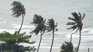
The primary threats from the cyclone are three-fold: destructive winds, torrential rain, and storm surge. Winds gusting to 145 kmph can cause extensive damage to vulnerable structures, uproot trees, and disrupt power and communication lines. Extremely heavy rainfall can lead to widespread waterlogging and flash floods. Additionally, the IMD has warned of a storm surge of up to 1.2 metres above normal tide levels, which could inundate low-lying areas in the districts of Prakasam, Bapatla, Krishna, West Godavari, Konaseema, Kakinada, and Visakhapatnam around the time of landfall. Fishermen have been strictly advised not to venture into the southwest, west-central, and northwest Bay of Bengal until November 21.
Where did the name 'Akvan' come from?
The name Akvan was contributed by Iran to the list of cyclone names for the North Indian Ocean region. The names are selected from a list prepared by 13 member countries of a regional panel, and are used sequentially. The name has roots in Persian mythology, specifically the epic 'Shahnameh'. Akvan Div is portrayed as a mythical, cunning demon or spirit. In one tale, the demon, known for doing the opposite of what is asked, is tricked by a hero. The naming of cyclones helps in identifying the storms and disseminating warnings without confusion.
How to stay safe and prepared?
Authorities have urged residents in the affected coastal areas to stay informed through official IMD bulletins and local media. It is crucial to secure homes, prepare emergency kits with essentials like food, water, and medicines, and keep mobile phones charged. People in low-lying areas should be ready to move to designated cyclone shelters if instructed by officials. Following the landfall, there is a risk of disruptions to transport, power, and water supply. The government is deploying disaster response teams and has instructed power distribution companies (DISCOMs) to be on high alert to ensure rapid restoration of services.