


Beyond the Guidebook
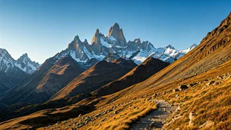
For decades, the most adventurous travellers relied on word-of-mouth or expensive guides to find the hidden corners of regions like Arunachal Pradesh or Nagaland. Standard digital maps, like the ones we use for city navigation, often show blank spaces
where remote communities thrive. Crowdsourced maps are different. Built by a global community of volunteers, locals, and travellers, platforms like OpenStreetMap (OSM) and community-curated Google Maps lists are filling in these blanks. They don't just show roads; they mark hiking trails, local homestays, sacred groves, and tiny riverside hamlets that commercial mapmakers miss. This is a map made by people, for people, offering a more granular and authentic view of the world.
Your Digital Compass to the Unknown
So, how do you tap into this digital treasure trove? Start with OpenStreetMap.org. It's a free, open-source map of the world. Zoom into a region like the Siang Valley in Arunachal Pradesh or the Ziro Valley and you'll find a level of detail that is often surprising. Look for faint lines indicating footpaths and small icons for homestays or points of interest. Next, search on Google for "offbeat Arunachal travel blog" or "Meghalaya community tourism." Many passionate travellers and local guides create detailed blog posts with GPS coordinates and custom Google Maps lists that you can save to your own phone. These resources are invaluable, often providing context, contact numbers for local families offering lodging, and tips on cultural etiquette. They are the modern-day equivalent of a well-marked treasure map.
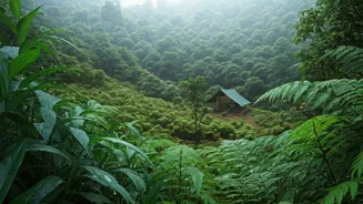
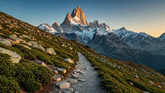
First Stop: The Siang River's Secrets
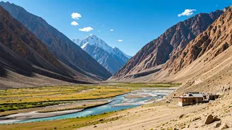
The mighty Siang River, which becomes the Brahmaputra downstream, carves a dramatic path through Arunachal Pradesh. While towns like Pasighat are well-known, the real magic lies in the smaller villages accessible only by foot or local transport. Using crowdsourced data, you can trace ancient trails connecting Adi villages like Yemsing, Karko, and Shimong. These maps might reveal a hanging bridge not listed anywhere else or a trail leading to a breathtaking viewpoint over the river. Travellers have used these community-updated maps to plan multi-day treks, staying in traditional bamboo homes along the way. This isn’t about just seeing a place; it's about experiencing the rhythm of life in a community that has lived in harmony with the river for centuries.
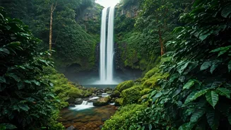
Meghalaya's Waterfalls and Root Bridges
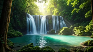
Meghalaya is famous for Cherrapunji and the double-decker living root bridge. But dozens more of these incredible bio-engineered marvels are scattered across the East Khasi Hills, many of them unmarked on mainstream maps. Local enthusiasts and explorers have meticulously documented trails to these lesser-known bridges and the pristine waterfalls often found near them. By following community-created tracks on apps like Maps.me (which uses OSM data), you can venture beyond the tourist crowds to places like the Mawsaw-root bridge or find trails around Kongthong, the 'whistling village.' These digital breadcrumbs lead to serene spots where you can experience the state's natural wonder without the crowds, guided by the collective knowledge of those who know the land best.
How to Travel Responsibly
With great access comes great responsibility. These villages are not tourist resorts; they are homes. When you use these maps to venture off the beaten path, you become an ambassador. Always hire a local guide if you are unsure of the trail. It supports the local economy and ensures your safety. Ask for permission before taking photographs of people or religious sites. Stay in designated homestays to ensure your money directly benefits the community. Carry your waste back with you, especially plastics. The beauty of these places lies in their pristine nature and preserved culture. Travelling with awareness and respect is the only way to ensure they remain that way for generations to come.