





A New Eye In The Sky: What is NISAR?
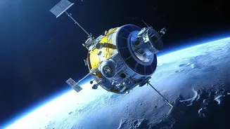
NISAR, which stands for NASA-ISRO Synthetic Aperture Radar, is a state-of-the-art Earth observation satellite. It is the result of a powerful collaboration between the Indian Space Research Organisation (ISRO) and the US National Aeronautics and Space Administration
(NASA). Launched on July 30, 2025, from India's Satish Dhawan Space Centre, this mission represents a new chapter in a growing partnership between the two space agencies. Under the agreement, NASA provided the L-band radar system, while ISRO developed the S-band radar and provided the spacecraft itself and the launch vehicle. Orbiting the Earth at an altitude of 747 kilometres, NISAR is designed to scan nearly the entire planet every 12 days, creating an unprecedented and detailed record of how our world is changing.
Seeing Through Clouds and Darkness
What makes NISAR a game-changer is its advanced radar technology. Unlike traditional optical satellites that need clear skies and daylight to capture images, Synthetic Aperture Radar (SAR) can see through clouds, rain, and darkness. It actively sends microwave signals to the Earth's surface and analyses the reflected signals, much like using a flash to take a photo in a dark room. NISAR is the first satellite mission to use two different radar frequencies—the L-band and S-band. This dual-frequency capability allows it to observe a wide range of changes on the Earth's surface. Calm water reflects the radar signal away, making it appear dark, which allows for clear identification of inundated areas. Crucially, the longer wavelength of the L-band radar can penetrate through forest canopies and vegetation, meaning it can detect flooding that would otherwise be hidden from view.
From Data to Disaster Response
The true power of NISAR lies in its ability to provide rapid, reliable data for disaster management. The satellite can provide information within hours of a disaster, helping first responders assess the extent of flooding and plan their response more effectively. By comparing images taken before and during a flood, analysts can create detailed maps showing precisely which areas are underwater. This is a significant improvement over relying solely on ground-based stream gauges, which are sparsely distributed. NISAR will act as a virtual network of stream gauges, capable of measuring even small changes in water levels across vast, remote, and vegetated floodplains. This steady stream of high-resolution data will feed into hydrological models, enhancing the accuracy of flood forecasts and giving communities more time to prepare and evacuate.
The Indian Context: A Critical Tool
For India, where monsoon rains and cyclones frequently cause widespread flooding, NISAR's capabilities are particularly vital. ISRO has already started making S-band data from the mission publicly available through its Bhoonidhi portal, including sample images of the Brahmaputra basin in Assam. This data will be invaluable for agencies like the National Disaster Management Authority (NDMA). The ability to accurately map the extent of floods, even in densely vegetated areas, will transform how authorities manage relief and rescue operations. It can help in identifying affected villages, assessing damage to infrastructure and crops, and planning long-term mitigation strategies. The mission aligns perfectly with India's national priorities of disaster risk reduction and climate resilience.
Beyond Floods: A Multipurpose Mission
While its impact on flood management is profound, NISAR's applications extend much further. The mission is designed to monitor a wide array of Earth's vital signs. For India, this includes tracking agricultural biomass over the crop cycle, assessing soil moisture for better farming, monitoring landslides in the Himalayas, and understanding the dynamics of glaciers and ice sheets. The satellite's data can detect tiny movements in the Earth's crust, offering insights into earthquake risks and volcanic activity. By providing comprehensive data on groundwater levels, it can also aid in the sustainable management of one of India's most critical resources. In essence, NISAR is a multi-faceted tool for scientific research and resource management.