


The Allure and the Alarm
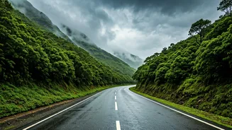
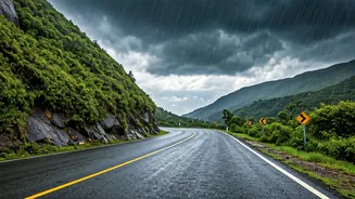
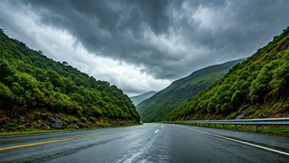
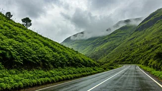
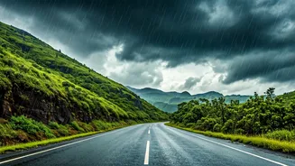
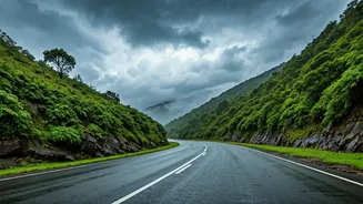
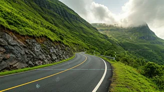
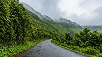
Driving through the Western Ghats during the monsoon is a bucket-list experience for many. The winding roads, flanked by cascading waterfalls and emerald-green landscapes, are intoxicating. However, this is also when the region is at its most volatile.
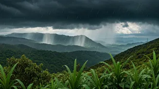
Heavy rains can trigger landslides, cause flash floods, and create perilous driving conditions with little to no warning. Roads that were perfectly safe an hour ago can become impassable. This is why local authorities often issue advisories, and seasoned travellers know that a successful trip isn’t just about the destination; it’s about navigating the journey with caution and intelligence. Relying on luck or old information is a recipe for disaster, turning a scenic drive into a stranded nightmare.
Your Digital Toolkit for the Ghats
The game-changer for modern explorers is real-time data. A smartphone with a decent data connection is now as essential as a spare tyre. A combination of general navigation apps, official government channels, and community-driven platforms can provide a comprehensive picture of what lies ahead. Before you even start your engine, you can get updates on road closures, active landslides, heavy traffic jams, and weather warnings. This digital toolkit doesn't just offer convenience; it’s a critical safety layer that empowers you to make informed decisions on the fly, whether it's rerouting, delaying your start, or cancelling the trip altogether.
Leveraging Mainstream Navigation Apps
Apps like Google Maps and Waze are the first port of call for most drivers. Their strength lies in crowdsourced real-time traffic data. The red, orange, and green lines are your first clue to congestion. More importantly, pay close attention to the incident icons. Users can report accidents, hazards, and road closures directly on the map. Before embarking on a route through a ghat section, zoom in and look for these user-generated reports. They are often the fastest source of information for a freshly blocked road. Always check for alternate routes offered by the app, but vet them carefully. A less-congested route might be a smaller, more treacherous village road that is even less safe in heavy rain.
Tuning into Official Channels
While navigation apps are fast, official sources are the most authoritative. State police departments and transport authorities are increasingly using social media and dedicated apps to disseminate crucial information. For instance, the highway police in states like Maharashtra and Karnataka often post updates on their official Twitter (now X) handles about major blockages on key highways like the Mumbai-Pune Expressway or routes leading to popular hill stations. Some districts also have their own disaster management portals or WhatsApp helplines. A quick search for the local district police or collector’s official social media pages before your trip can yield invaluable, verified information on closures and safe travel windows.
The Power of the Community
Beyond apps and officialdom lies the power of the travel community. Rider and driver groups on platforms like Facebook and WhatsApp are goldmines of on-the-ground information. Members often post real-time photos and videos of road conditions, sharing advice on which sections to avoid. Joining a few well-regarded travel groups specific to the region you're visiting can give you insights that automated systems might miss. This human intelligence network can warn you about a newly formed pothole, a waterlogged underpass, or a minor landslide that hasn’t yet been registered officially. The key is to cross-reference this information and not rely on a single unverified post.
Your Pre-Trip Tech Checklist
Before you leave, prepare your digital dashboard. First, download offline maps for your entire route; network connectivity can be patchy in the mountains. Second, charge all your devices and carry a fully charged power bank. Third, save the contact numbers for local emergency services and highway patrol for the districts you'll be passing through. Finally, spend 15 minutes checking all your sources—Google Maps for real-time traffic, official Twitter handles for closures, and community groups for anecdotal reports. This simple ritual can be the difference between a memorable adventure and a preventable ordeal.