





Decoding the IMD's Warning
First, let's understand the alert itself. The IMD uses a colour-coded system—Yellow (Be Aware), Orange (Be Prepared), and Red (Take Action)—to communicate the severity of expected weather. A multi-day forecast, which can now predict heavy rainfall up
to seven days in advance, indicates a sustained period of risk. This is fundamentally different from a single, sharp downpour. It means authorities aren't just preparing for one impact, but a prolonged event that can saturate the ground, swell rivers continuously, and strain infrastructure over several days, making hazards like flash floods and landslides more likely.
What Exactly Are 'Last-Mile Checks'?
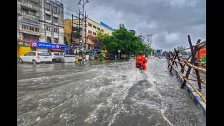
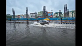
The term 'last-mile' refers to the final, and often most challenging, stage of disaster management: translating a high-level warning into concrete, on-ground action that protects a specific neighbourhood or community. It’s where policy meets the pavement. These checks are the tangible work done by municipal corporations, district administrations, and local disaster response teams. This includes pre-monsoon desilting of drains, inspecting the stability of old buildings and embankments, checking on vulnerable low-lying areas, ensuring pumping stations are operational, and clearing potential blockages that could worsen waterlogging. It’s the unglamorous but essential groundwork that determines whether a city floods or stays afloat.
From Forecast to Ground Action
The process follows a clear chain of command. An IMD alert is transmitted to the National Disaster Management Authority (NDMA) and State Disaster Management Authorities (SDMAs). These bodies then direct the relevant district and city-level agencies to activate their standard operating procedures (SOPs). For instance, the National Highways Authority of India (NHAI) will deploy teams to vulnerable stretches of highways prone to landslides, equipping them with machinery for rapid clearing. Similarly, railway authorities monitor tracks in high-risk zones, sometimes installing their own automatic weather stations to get hyper-local data. At the city level, emergency operation centres coordinate with police, fire services, and public works departments to prepare for waterlogging and potential rescue operations.
The Unique Challenge of a Sustained Alert
A multi-day rain alert presents a distinct set of problems. The primary challenge is the immense strain on resources and personnel. Keeping rescue teams, equipment, and officials on high alert for 72 hours or more is logistically complex and physically draining. There is also the risk of 'alert fatigue' among the public; an initial warning might be taken seriously, but by day three, a sense of complacency can set in, making people less likely to follow safety advisories. Furthermore, the cumulative effect of continuous rain is difficult to predict. Soil that absorbs water on day one may be completely saturated by day three, suddenly giving way to a landslide. This is why continuous monitoring, not just a one-time preparation, is vital during prolonged alerts.
Strengthening the Final Link
Recognising that the last mile is often the weakest, authorities are increasingly turning to technology and community involvement. The IMD now uses advanced AI-driven models to provide more granular, impact-based forecasts that can predict the potential rise in river levels, not just the amount of rain. Mobile apps like 'SACHET' and the Common Alerting Protocol (CAP) are used to push warnings directly to citizens' phones. On the ground, the role of community-based disaster management is crucial. Local volunteers and Panchayati Raj Institutions are often the first responders, helping to disseminate warnings in local languages, assist in evacuations, and identify specific risks that large-scale plans might miss. This combination of high-tech forecasting and hyper-local human networks is key to building true resilience.