








A New, More Precise Eye in the Sky
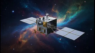
On July 7, 2026, a suitcase-sized satellite named GRITSS was launched into orbit aboard a SpaceX rocket. The name is an acronym for Geodetic Reference Instrument Transponder for Small Satellites, and its mission is as complex as its name suggests. In short,
GRITSS aims to solve a long-standing problem for anyone who relies on ultra-precise location data. Currently, the world's positioning systems rely on three different techniques: GPS (or more broadly, GNSS), Satellite Laser Ranging (SLR), and Very Long Baseline Interferometry (VLBI). These systems work independently, and when their data is combined to create the International Terrestrial Reference Frame (ITRF)—the global grid that underpins everything from climate science to civil engineering—tiny errors of a few millimeters creep in. GRITSS is designed to eliminate those errors by acting as a single, unified reference point in space that all three systems can talk to simultaneously.
The 'Demonstration' Distinction
The key to understanding GRITSS lies in its official designation as a "technology demonstration" mission. This isn't just bureaucratic jargon; it’s a critical distinction. The satellite's main goal isn't to provide a continuous, operational service but to prove that its novel technology actually works in the harsh environment of space. The mission is a collaboration between NASA, the University of Massachusetts Lowell, and the Dutch small-satellite manufacturer ISISPACE. Jeroen Rotteveel, CEO of ISISPACE, noted that GRITSS is an "excellent example of how commercial spacecraft capabilities can help accelerate scientific innovation." In other words, its success will be measured by its ability to validate new techniques that can be used in future, more robust missions, not by its own operational output. The primary goal is to achieve the Earth Science Decadal Survey's target of 1-millimeter reference frame accuracy, a feat that would dramatically improve our ability to track changes in sea level, ice sheets, and land masses.
Ingenious Technology Under the Hood
At its core, GRITSS is a translator. It carries a modified GPS receiver that captures navigation signals, upconverts them in real-time to different frequencies (S-band and X-band), and then broadcasts those new signals down to VLBI radio telescopes on the ground. This creates a common language between the GPS and VLBI networks. Simultaneously, it carries a laser retroreflector array, allowing SLR ground stations to bounce lasers off it to measure distance. For this to work, timing is everything. The system uses an ultra-stable oscillator to keep its internal clock accurate to within a trillionth of a second. The engineering team also had to solve for extreme temperature swings as the CubeSat orbits the Earth, which could disrupt that sensitive timing. They implemented thermal controls to keep the satellite's internal temperature stable to within a single degree Celsius.
What Success Looks Like for GRITSS
Following its launch, ISISPACE engineers are managing the satellite's initial commissioning phase from their operations center. This involves establishing contact, checking that all systems are working, and preparing for payload operations. For the geospatial and space industries, the promise of GRITSS is immense. A more accurate ITRF would enhance a huge range of applications, from improving next-generation topography missions to enabling future satellite constellations to more precisely track continental movements and the planet's changing shape. However, the mission is still in its infancy. The technology has to be proven to work reliably over its planned one-year lifespan. Only after the data from this demonstration is analyzed will the full potential of this approach be understood and, eventually, integrated into permanent systems.