


The Treacherous Beauty of the Ghats
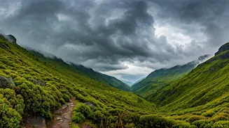
Stretching over 1,600 kilometres along India's western coast, the Western Ghats are a UNESCO World Heritage Site, famed for their breathtaking biodiversity and stunning landscapes. For the millions who live and travel within this region, however, the beauty
comes with a constant, underlying risk. The steep slopes, heavy seasonal rainfall, and fragile geology make the Ghats highly susceptible to natural disasters. During the monsoon, from June to September, highways that snake through the mountains become particularly dangerous. Landslides can bury entire sections of road in seconds, flash floods can wash away bridges, and falling rocks can turn a routine drive into a life-threatening ordeal. For decades, the approach to these dangers was reactive: wait for a disaster to happen, then mount a rescue and repair operation. But that is finally changing.
The Rise of Digital Watchmen
The solution lies in shifting from reaction to proaction. Instead of just responding to landslides, what if we could predict them? This is the promise of real-time alert systems. These are not just generic weather warnings; they are sophisticated networks designed to monitor specific, high-risk stretches of road. By combining on-ground technology with advanced data analysis, these 'digital watchmen' keep a constant vigil on the mountainsides. They are designed to detect the subtle, early-warning signs of an impending landslide or flash flood, giving authorities precious time to close a road, divert traffic, and prevent travelers from driving into a danger zone. States like Kerala, Karnataka, and Maharashtra have been at the forefront of deploying these systems along critical highway sections.
How the Technology Works
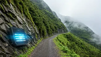
At the heart of these systems is a network of Internet of Things (IoT) sensors. These are not your everyday gadgets. Specialised sensors, including extensometers, tiltmeters, and piezometers, are strategically installed deep into the soil and rock of vulnerable slopes. They measure critical parameters in real-time: changes in soil moisture, pore water pressure (the pressure of groundwater held within soil), and minute ground movements or vibrations. This data is transmitted wirelessly, often every few minutes, to a central server. Simultaneously, automated weather stations collect localised rainfall data. Heavy, sustained rainfall is a primary trigger for landslides, so correlating precipitation with ground movement is key. All this information is fed into an analytical engine, often powered by artificial intelligence (AI), which has been trained to recognise the specific patterns that precede a landslide.
From Data to Your Dashboard
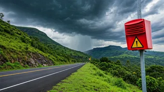
Collecting data is only half the battle. The crucial final step is getting a clear, actionable warning to the people who need it most: the travelers. When the system's algorithm detects a high probability of a landslide, it triggers an automated, multi-level alert. First, it notifies the control rooms of the State Disaster Management Authority (SDMA), local police, and public works department. These authorities can then make an informed decision to close the road. This information is then rapidly disseminated to the public. Alerts are pushed out via SMS blasts to mobile numbers in the vicinity, posted on official social media channels of district administrations and traffic police, and broadcast on FM radio. Some states are also integrating these warnings into dedicated mobile apps, providing travelers with a one-stop source for route safety information before they even begin their journey.
Success Stories from the Slopes
The impact of these systems is already being felt. In Kerala, a landslide warning system developed by Amrita Vishwa Vidyapeetham has been instrumental in providing early warnings in the Idukki and Wayanad districts, areas repeatedly devastated by past disasters. Authorities have been able to evacuate people and divert traffic based on these specific, technology-driven alerts, preventing potential loss of life. Similarly, pilot projects along the Mumbai-Pune Expressway and certain ghat sections in Karnataka have demonstrated the system's effectiveness. By providing warnings hours in advance, authorities have been able to manage traffic flow proactively, avoiding the massive, multi-day gridlocks that once followed any major landslide. It’s a quiet success story, measured not in dramatic rescues but in the disasters that are averted.