


The Legend That Sparked the Hunt
The story of Mahabalipuram is incomplete without the myth of its submerged temples. Ancient folklore and accounts from early European travellers speak of Seven Pagodas that once lined the shore. Today, only one, the magnificent Shore Temple from the 8th
century Pallava dynasty, stands against the waves. The legend says the gods grew jealous of the city's beauty and sent a great flood, submerging the other six structures. For generations, this was just a beloved story. But in 2004, a tragedy provided a startling clue. When the Indian Ocean tsunami waters receded momentarily from the coast, eyewitnesses reported seeing long rows of large stone blocks and the outlines of ruined structures before the sea rushed back in to cover them. This event transformed the myth into a tangible scientific quest.
The First Sweep: Seeing with Sound
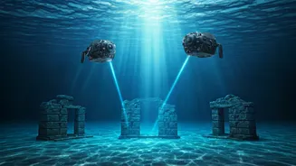
The hunt for submerged ruins begins not with a dive, but with sound. Marine researchers, primarily from India's National Institute of Oceanography (NIO) and the Archaeological Survey of India (ASI), start with a broad survey of the seabed. The primary tool for this is side-scan sonar. A device, often towed behind a survey ship, sends out wide, fan-shaped pulses of sound. These sound waves travel to the ocean floor, bounce off it, and return to a sensor. By measuring the time it takes for the echoes to return and their strength, the system creates a detailed, almost photographic image of the seafloor's topography. It can’t see through the sand, but it reveals any unnatural shapes, protrusions, or long, straight lines on the surface that could indicate man-made structures hiding in plain sight on the seabed.
Peering Below the Sand
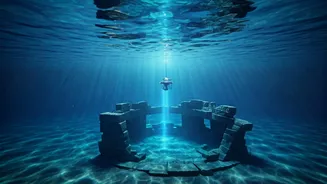
Once sonar identifies anomalies on the surface, the next question is what lies buried beneath the sediment. For this, researchers employ a sub-bottom profiler (SBP). This instrument works similarly to sonar but uses lower-frequency acoustic waves that can penetrate the seabed. As the waves travel down, they reflect off different layers of sediment and any solid objects buried within them, like compacted soil, rock, or brick foundations. This allows scientists to create a cross-sectional map of the layers beneath the seafloor, revealing the profiles of buried channels, walls, or foundations without any digging. This non-invasive technique is crucial for identifying promising dig sites and understanding the geological history of the area, helping to piece together how and when these structures may have been submerged.
Sending in the Robotic Scouts
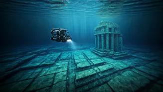
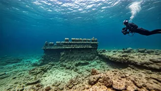
With promising targets identified, it's time for a closer look. Before sending human divers into potentially difficult or unknown underwater environments, teams often deploy Autonomous Underwater Vehicles (AUVs) or Remotely Operated Vehicles (ROVs). These unmanned robotic submersibles are equipped with high-resolution cameras, powerful lights, and sometimes even robotic arms. They can be guided to specific coordinates pinpointed by sonar and sub-bottom profiler data. The ROVs provide the first visual confirmation, sending back live video of the seabed. This allows archaeologists to see the condition of the structures, identify architectural features, and assess whether the formations are natural rock or man-made constructions covered in marine growth. This step is vital for planning safe and effective human dives.
The Final Step: Human Exploration
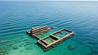
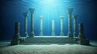
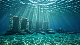
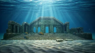
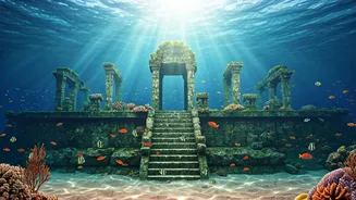
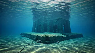
After the high-tech groundwork is laid, marine archaeologists and trained divers from institutions like the Indian Navy and ASI take the plunge. Their job is to physically inspect, document, and sometimes carefully excavate the sites confirmed by the remote sensing data. Underwater work is incredibly challenging due to strong currents, poor visibility, and the delicate nature of ancient structures covered in centuries of marine life. Divers use specialised equipment to measure, photograph, and create detailed site plans of the ruins. In joint expeditions off Mahabalipuram, divers have confirmed the existence of long walls, flights of stairs, and scattered, dressed stone blocks at depths of 5 to 8 metres. These discoveries provide concrete, physical proof that substantiates the legends.
What the Maps Have Revealed
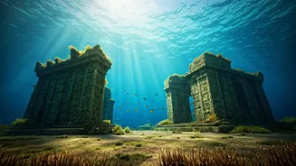
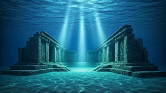
So, what has this combination of technology and exploration found? The research has confirmed that a large man-made complex did indeed exist off the coast. Surveys have uncovered remains of walls, one stretching as long as 70 metres, and evidence of what appear to be at least two other submerged temples and a cave temple within 500 metres of the shore. While not a perfect match for the legend of six pristine pagodas, the findings strongly indicate that a significant part of the ancient Pallava-era settlement was lost to the sea. Experts believe these structures were likely submerged over time due to severe coastal erosion or a past tsunami-like event, possibly as far back as the 13th century. The mapping continues, turning a beloved myth into a documented chapter of India's history.