
Grassi Lakes: An Accessible Wonder
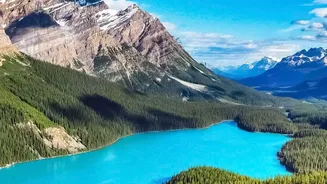
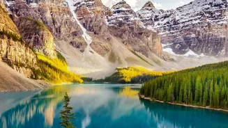
Located just outside Canmore, the Grassi Lakes trail is a family-friendly favourite known for its incredibly short path and stunning reward. The hike itself is a relatively easy 4.3 km round trip with a modest elevation gain of about 203 metres, making
it accessible for most skill levels. Hikers are presented with two options: an easier, wide gravel path and a slightly more challenging 'difficult' route that offers better views of a waterfall and the Bow Valley below. Both trails culminate at two mesmerizing, turquoise-coloured lakes. These shallow, vibrant pools, set against a dramatic cliffside often dotted with rock climbers, provide a picture-perfect resting spot. For the best panoramic view of the town of Canmore, be sure to look for a viewpoint just before you reach the lakes themselves.
Johnston Canyon to the Ink Pots: Waterfalls and Meadows
This popular hike in Banff National Park is a journey of ever-changing scenery. The trail begins with a captivating walk through Johnston Canyon on a series of catwalks fixed to limestone cliffs, taking you right over the rushing water. The first major viewpoints are the Lower Falls (1.2 km in) and the Upper Falls (another 1.2 km further). While many stop here, continuing for another 3 km will lead you out of the forest and into a stunning alpine meadow. Here you'll find the Ink Pots: seven crystal-clear, bubbling mineral springs with brilliant green and blue hues. The full hike to the Ink Pots and back is roughly 11.4 km with about 330 metres of elevation gain, taking most people 4 to 5 hours to complete. The sight of these unique pools against a backdrop of towering mountain peaks is an unforgettable reward.
Plain of Six Glaciers: A Teahouse in the Sky
Starting from the iconic shoreline of Lake Louise, this moderate hike offers some of the most dramatic glacial scenery in Banff. The trail is approximately 5.5 km one-way to a historic stone teahouse built in 1927. After a flat walk along the lakeshore, the path begins a steady climb of about 365 metres, ascending into a valley carved by ice. The viewpoint from the teahouse itself is spectacular, offering a close-up look at hanging glaciers and towering rock faces. For an even better perspective, continue 1.5 km past the teahouse to the Abbot Pass viewpoint. From this vantage point, you can truly appreciate the scale of the lower Victoria Glacier, and you may even hear the distant rumble of avalanches. The entire round trip, including the final viewpoint, typically takes 5 to 6 hours.
Wilcox Pass: A Glacier Panorama
Located on the stunning Icefields Parkway in Jasper National Park, the Wilcox Pass hike is renowned for delivering incredible views for a moderate amount of effort. The trail climbs steadily through a subalpine forest before opening up into vast alpine meadows. The main viewpoint looks directly across the valley at the Athabasca Glacier, Snow Dome, and the vast Columbia Icefield, offering a perspective you can't get from the road below. The hike is about 8 to 9.5 km for the round trip, with an elevation gain of roughly 335-390 metres, and usually takes between 3 to 5 hours. It's a fantastic way to experience the grand scale of the icefields and is often considered one of the best half-day hikes in the Rockies.
Sulphur Skyline: A 360-Degree Summit View
For those willing to tackle a steep climb, the Sulphur Skyline trail in Jasper delivers one of the most rewarding panoramic views in the park. This strenuous 8 km round-trip hike involves a significant elevation gain of 700 metres. The trail starts near Miette Hot Springs and ascends sharply through the forest before breaking out onto an open, treeless ridge. The final push to the summit is steep and rocky, but the effort is well worth it. At the top, you are rewarded with an unobstructed 360-degree vista of the Fiddle River Valley and the surrounding mountain ranges. As a unique bonus, you can end your hike with a relaxing soak in the Miette Hot Springs, the hottest mineral springs in the Canadian Rockies.