





From the Ground Up to the Stars
For decades, weather forecasting relied on ground-based observations: rain gauges, thermometers, and weather balloons. While essential, these tools provide an incomplete picture of our planet’s vast and dynamic atmosphere. India’s diverse and often extreme
weather, from Himalayan blizzards to coastal cyclones, presented a unique challenge that could not be met from the ground alone. Forecasters needed a higher vantage point to see the bigger picture. This need spurred the Indian Space Research Organisation (ISRO) to develop a dedicated satellite program for meteorology, transforming weather prediction from a reactive practice into a proactive, life-saving science.
India's Eyes in the Sky
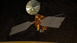
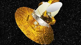
The backbone of India's space-based weather watch is the Indian National Satellite (INSAT) system. Starting in the early 1980s, this series of multipurpose geostationary satellites began providing crucial data. Today, advanced meteorological satellites like INSAT-3D and its successor, INSAT-3DR, are the primary sentinels. Launched by ISRO, these satellites are equipped with sophisticated instruments called imagers and sounders, which work in tandem to monitor the Indian subcontinent and surrounding oceans around the clock. The data they gather is beamed down to the India Meteorological Department (IMD), where it becomes the foundation for modern forecasts.
What Satellites 'See' to Predict Rain
Meteorological satellites don't just take simple pictures. Their instruments capture information across different wavelengths of light, including visible and infrared. This allows them to measure critical parameters like cloud top temperature, which indicates the height and potential intensity of a storm. They track cloud motion vectors to determine wind speed and direction at various atmospheric levels. Furthermore, they measure sea surface temperature, a key factor in the formation of cyclones, and monitor the moisture content in the atmosphere. This constant stream of data, updated as frequently as every 15 minutes, feeds into powerful supercomputers that run complex numerical weather prediction models.
The Cyclone Sentinels
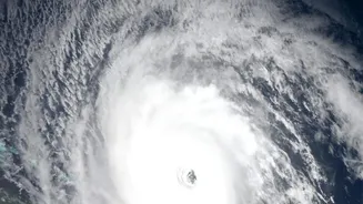
Perhaps the most dramatic impact of satellite technology has been on cyclone forecasting. Before the satellite era, cyclones could form over the open ocean and make landfall with little warning, leading to catastrophic loss of life. Today, satellites can detect the formation of a low-pressure area far out at sea. As the system intensifies, continuous satellite imagery allows the IMD to precisely track its path, predict its intensity, and forecast where it will make landfall. This has enabled disaster management agencies to issue timely evacuation orders for coastal populations, reducing cyclone-related fatalities by orders of magnitude and turning a once-unpredictable threat into a manageable crisis.
Decoding the All-Important Monsoon
The Indian monsoon is the lifeblood of the nation's agriculture-based economy, but its behaviour is notoriously complex. Satellites play a crucial role in improving monsoon predictions. By providing a continuous, large-scale view of cloud patterns, sea surface temperatures in the Indian Ocean, and moisture transport, they help forecasters understand the onset, progression, and withdrawal of the monsoon. The assimilation of this satellite data into forecast models has improved accuracy by 20% to 30%. This enables better long-range forecasts, which are vital for government policy, water resource management, and for millions of farmers making decisions about when to plant their crops.
The Future is Higher Resolution
The evolution of Indian weather forecasting continues. ISRO is constantly working on the next generation of satellites with even more advanced capabilities. The recently launched INSAT-3DS, for example, enhances the monitoring of vertical atmospheric profiles like temperature and humidity. Future plans include instruments like lightning imagers and hyperspectral sounders that will provide data with unprecedented detail. Furthermore, the integration of Artificial Intelligence (AI) and machine learning with this wealth of satellite data promises even more accurate, hyperlocal forecasts, bringing weather alerts right down to the village level.