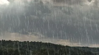







Start with Official Forecasts
Your first step should always be to check the official source: the India Meteorological Department (IMD). The IMD issues district-level weather warnings using a colour-coded system that is crucial to understand. A Green alert means no advisory is needed.
A Yellow alert advises you to 'Be Aware', as bad weather is likely and could disrupt daily activities. An Orange alert means 'Be Prepared' for extremely bad weather that could disrupt travel, power, and communication. The most serious is a Red alert, which means 'Take Action'. A red alert indicates a serious threat to life and property from severe weather, and you should avoid travel. You can access these alerts via the official 'Mausam' app, which provides current weather information, forecasts, and warnings.
Use Multiple Weather Apps
While the IMD's Mausam app is the official source, it’s wise to corroborate information with other reliable private weather services. Apps like Skymet Weather, another 'made in India' service, provide detailed forecasts by analysing data from thousands of automatic weather stations across the country. International apps like AccuWeather are known for their 'MinuteCast' feature, which predicts rain on a minute-by-minute basis for the next two hours. The Weather Channel and Windy are also excellent resources, providing live radar maps to track storms. Using a combination of these apps gives you a more comprehensive picture of what to expect, from hourly forecasts to real-time precipitation.
Assess Landslide and Flood Risks
If you are travelling to hilly or coastal regions, checking the general weather forecast isn't enough. You must specifically assess the risk of landslides and flash floods. The Geological Survey of India (GSI) is the nodal agency for landslide information, and ISRO's National Remote Sensing Centre (NRSC) provides detailed landslide maps. You can also consult resources from the National Disaster Management Authority (NDMA) and your destination's State Disaster Management Authority (SDMA). For flood risks, the Central Water Commission (CWC) operates a flood forecasting network covering major rivers and reservoirs. Look for signs like recent heavy rainfall, rising river levels, or proximity to historically flood-prone zones. Avoid travelling on routes known for landslides, especially after sustained downpours.
Gather On-the-Ground Intelligence
Digital tools are essential, but they don't replace local knowledge. Before you leave, call your hotel, resort, or local host. Ask them directly about the current road conditions, accessibility, and any local advisories. They will have the most current information about whether a specific road is blocked, if a local stream is overflowing, or if certain attractions are closed. This is particularly important in remote areas where mobile connectivity might be poor and online updates infrequent. Local drivers, shopkeepers, and guides are also invaluable sources of real-time information. Heed their advice if they warn against travelling on a particular route.
Check Your Route and Have a Backup Plan
A clear forecast at your destination doesn't guarantee a safe journey. The roads and highways leading there can be severely affected by rain. Check for information on road closures or disruptions before you start driving. Avoid driving at night in hilly areas during the monsoon, as fog, rain, and the risk of falling debris make it extremely hazardous. Never attempt to cross flooded roads or bridges. The most crucial part of monsoon travel planning is flexibility. Heavy rain can cause sudden and significant delays. Build buffer days into your itinerary and have a Plan B. This could mean having an alternative route planned or being prepared to stay an extra day if the weather turns.