







A New Eye in the Sky: Introducing NISAR
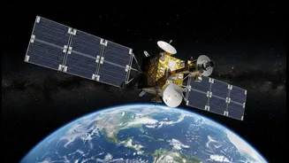
The satellite at the heart of this new era of Earth observation is NISAR, a joint mission between NASA and the Indian Space Research Organisation (ISRO). Standing for NASA-ISRO Synthetic Aperture Radar, this advanced observatory is the first satellite to use
two different radar frequencies (L-band and S-band) to measure changes in our planet's surface. Launched from India, this ambitious project is designed to scan nearly the entire globe every 12 days, gathering a torrent of data that will reveal the Earth's processes in stunning detail. With an estimated cost of $1.5 billion, it is one of the most expensive Earth-imaging satellites ever built, a testament to the scientific value placed on its mission.
Seeing the Unseen with Radar
Unlike traditional optical satellites that are essentially cameras in space, limited by clouds and darkness, NISAR uses a technology called Synthetic Aperture Radar (SAR). SAR works by sending microwave pulses down to Earth and measuring the signals that bounce back. This active sensing allows it to 'see' through clouds, smoke, and even dense forest canopies, day or night. The 'Synthetic Aperture' part is a clever technique where the motion of the satellite is used to simulate a much larger antenna than it could physically carry, enabling it to produce incredibly high-resolution images. The mission’s dual-frequency capability is a game-changer; the L-band radar can penetrate vegetation to see the ground beneath, while the S-band is excellent for tasks like monitoring soil moisture.
A Powerful Partnership for India
The collaboration on NISAR is a major milestone in the India-U.S. strategic partnership, positioning both nations at the forefront of climate science and Earth observation. For this mission, ISRO provided the spacecraft itself, the S-band radar system, and the powerful GSLV rocket for the launch. NASA contributed the L-band radar, the high-rate communication subsystem for the massive data downloads, and other critical components. This joint effort provides India with direct access to incredibly sophisticated data, tailored to address specific national priorities. ISRO has identified key applications including monitoring Himalayan glaciers, tracking agricultural biomass, and improving disaster management strategies for the unique challenges the country faces.
Tangible Benefits on the Ground
The precision of NISAR translates directly into practical benefits. The satellite can detect changes in the ground surface as small as a centimetre. This is revolutionary for disaster management, offering the potential to spot the subtle ground deformation that can precede earthquakes, volcanic eruptions, or landslides. For agriculture, its ability to measure soil moisture across vast farmlands can help optimise irrigation and improve crop yields, enhancing food security. In a country vulnerable to climate change, NISAR's data will be crucial for monitoring the retreat of Himalayan glaciers, understanding changes in coastal regions like the Sundarbans, and tracking groundwater levels. Furthermore, its open data policy will make this critical information a global public good, empowering scientists and governments worldwide.