






The Science of the Great Reversal
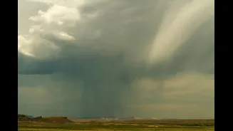
The monsoon is more than just rain; it's a massive seasonal reversal of wind patterns. During summer, warm, moist winds from the southwest blow from the Indian Ocean onto the subcontinent, bringing widespread rainfall. The monsoon retreat marks the end
of this cycle. As the landmass begins to cool faster than the ocean in autumn, the pressure systems shift. The moist southwesterly winds weaken and are gradually replaced by cooler, drier northeasterly winds, which blow from the land towards the sea. The India Meteorological Department (IMD) officially declares the withdrawal based on specific criteria, including a dry spell of at least five continuous days, a significant drop in moisture, and the establishment of an anticyclone (a high-pressure system) in the lower atmosphere.
When and Where Does It Begin?
The monsoon's exit is a staggered, weeks-long affair, not a sudden stop. It typically begins in the extreme northwestern parts of the country, starting with West Rajasthan. While there's no fixed date, the process historically starts in early September. However, for 2026, forecasters note that while satellite imagery shows a significant reduction in cloud cover over many regions, the official withdrawal has not yet begun. Strong northwesterly winds have started ushering in drier air, leading to clearer skies in Delhi-NCR, Punjab, Haryana, and Rajasthan. Current weather models suggest that conditions will become increasingly favourable for a more organised retreat after September 15, with an anticyclone expected to fully mature around September 21.
A Tale of Two Weather Patterns
As the monsoon withdraws from the north, it doesn't mean the end of rain for everyone. The retreat line slowly moves southeast across the country over several weeks. This means that in mid-September, Delhi might be experiencing dry, post-monsoon weather while regions in the south are still in the midst of active monsoon conditions. In fact, the post-monsoon period can trigger what's known as the northeast monsoon, which brings significant rainfall to the southern peninsula, particularly Tamil Nadu, coastal Andhra Pradesh, and parts of Karnataka, between October and December. For now, the IMD has noted that subdued rainfall is likely to continue over Peninsular India for the next week.
Looking Back at the 2026 Season
The 2026 monsoon season has been marked by erratic behaviour. Forecasts early in the season warned of a potentially weaker monsoon, influenced by developing El Niño conditions. As of early September, the country as a whole was reported to have a 14% rainfall deficit. The distribution has been highly uneven; while some parts of the north faced landslides from intense bursts of rain, large areas in the south, including coastal Andhra Pradesh and Rayalaseema, remained significantly dry. In August, private forecaster Skymet revised its monsoon outlook, predicting seasonal rainfall at 85% of the Long Period Average (LPA) and citing a 70% chance of drought conditions.
What to Expect Next
For North and Northwest India, the immediate forecast is a spell of hot and dry weather. The arrival of dry northwesterly winds is expected to reduce rainfall activity and push daytime temperatures higher, bringing back sunshine and clear blue skies. While this marks a break from the persistent cloud cover, the transition across the rest of the country will be more gradual. The complete withdrawal from the entire country, including the southern peninsula, typically does not happen until after October 1. This transition phase signals the end of the four-month rainy season and the onset of the post-monsoon or autumn season, bringing cooler, more pleasant weather to many parts of India.