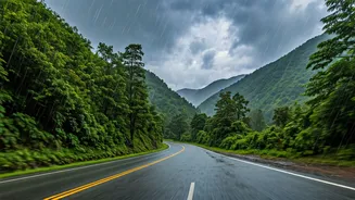


The Ghats' Hidden Dangers
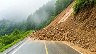
The annual monsoon transforms the majestic Western Ghats into a volatile landscape. While the rain brings lush greenery, it also dramatically increases the risk of travel. The primary concerns for highway travellers are landslides and rockfalls. The saturated
soil on steep slopes can give way without warning, blocking roads and, in the worst cases, sweeping away vehicles. Flash floods are another significant threat. Small streams can swell into raging torrents in minutes, submerging low-lying bridges and sections of the highway. Adding to the peril is drastically reduced visibility due to heavy fog and relentless downpours, making it difficult to spot hazards or navigate sharp hairpin bends. These conditions can lead to sudden road closures, leaving travellers stranded for hours or even days. The advisory to use real-time alerts isn't just a suggestion; it's a crucial safety measure in response to these very real and present dangers.
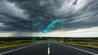
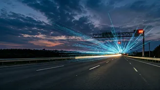
What 'Real-Time Alerts' Mean for You
The term 'real-time alerts' refers to dynamic, up-to-the-minute information delivered directly to your smartphone. This isn't just your standard GPS navigation; it's a live feed of changing conditions. The most common and accessible source is the traffic layer on apps like Google Maps or Waze. These apps use crowdsourced data from other drivers to identify traffic jams, accidents, and road closures. When multiple users slow down or stop in an area where a landslide has occurred, the app's algorithm flags it as a major disruption and automatically reroutes other drivers. These alerts can appear as on-screen warnings, colour-coded traffic lines (red for stopped traffic), or specific icons indicating a hazard ahead. The 'real-time' aspect is key—it’s not based on historical data but on what is happening on that road, right now.
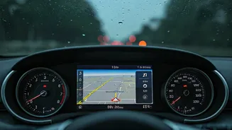
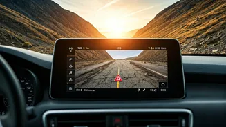
How to Activate Alerts on Google Maps
For most travellers, Google Maps is the default navigation tool, and enabling its full potential is simple. Before you start your journey, ensure your phone's location services and mobile data are on. First, open the app and tap your profile picture, then go to 'Settings' and 'Navigation settings'. Under 'Sound & voice', make sure your 'Mute state' is set to 'Unmuted' and the 'Guidance volume' is loud enough to hear over your car stereo or conversation. More importantly, under 'Map display', ensure 'Traffic' is enabled. This will show you the green, orange, and red lines indicating traffic flow. When you input your destination and start navigation, the app will automatically provide voice alerts for faster routes, accidents, and road closures reported ahead. Paying attention to these audio cues and the on-screen information can give you the precious minutes needed to choose a safer alternative route.
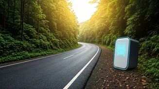
Beyond Navigation: Weather and Disaster Apps
While Google Maps is excellent for traffic, a comprehensive safety strategy involves layering your information. For weather-specific warnings, consider downloading apps from the India Meteorological Department (IMD), such as 'MAUSAM'. This app provides current weather conditions, forecasts, and official warnings for heavy rainfall, cyclones, and other severe weather events, often with district-level accuracy. Another critical government app is 'Damini', which provides early warnings for lightning strikes—a serious hazard in open areas during thunderstorms. By having these apps on your phone and allowing notifications, you get a more complete picture of the potential risks, combining traffic data with official meteorological advisories.
When Technology Fails: The Human Element
Technology is a powerful co-pilot, but it's not infallible, especially in remote ghat sections where mobile connectivity can be patchy. Never rely on your phone as your only source of information. The most reliable 'alert' is often a physical one: a police barricade. Never attempt to bypass official roadblocks; they are there for your safety. Supplement your digital alerts with 'analogue' ones. Tune into local FM radio stations, which often broadcast updates from district authorities. When you stop for tea or fuel, talk to the locals. A shopkeeper or truck driver will often have the most current and practical information about the road conditions ahead. Combining high-tech alerts with this on-the-ground human intelligence is the smartest way to travel.