




The Problem with 'City-Wide' Rain Predictions
Traditional weather forecasts provide a general outlook for an entire city or a large district. While helpful, they often fail to capture the highly localized and erratic nature of monsoon showers. One part of a city like Mumbai or Delhi can be drenched,
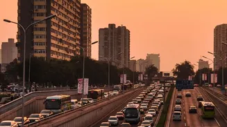
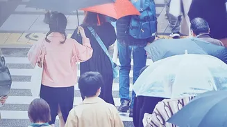
causing immediate waterlogging and traffic chaos, while another area remains completely dry. This variability makes it nearly impossible to plan a commute or trip based on a simple 'rain likely' prediction. Commuters are left guessing, often leading to hours stuck in traffic, navigating flooded underpasses, or getting soaked unexpectedly. Recent monsoon spells have repeatedly highlighted this challenge, with flights being delayed and traffic coming to a standstill in major metros due to sudden, intense downpours that weren't pinpointed in broader forecasts.
Enter the Hyperlocal Revolution
This is where route-level forecasting changes the game. Instead of telling you the weather for a whole city, this technology provides a minute-by-minute weather prediction for the specific path you are travelling. Using a powerful combination of high-resolution satellite imagery, Doppler radar, real-time traffic data, and artificial intelligence, these systems create a dynamic weather map layered onto your route. Think of it as a personal weather bubble that moves with you. Some services can predict with remarkable accuracy when precipitation will start and stop right down to your street level. This shift from macro to micro-forecasting is a significant leap, empowering individuals with data that is immediately relevant to their journey.
Your Personal Monsoon Navigator
The practical benefits are immense. With a route-level forecast, you can see if a heavy spell of rain is expected on your planned route in the next 30 minutes, allowing you to delay your departure or choose an alternative path. These apps can proactively warn you about roads that are already waterlogged or where traffic has slowed to a crawl due to the weather. Some advanced navigation services are already integrating these features, suggesting smarter routes that not only avoid traffic but also steer clear of impending downpours and their immediate consequences. This turns your navigation app from a simple map into an intelligent tool for outsmarting monsoon disruptions, saving you time and stress while enhancing your safety on the roads.
Finding and Using These Tools
Accessing this technology is becoming easier. Many popular weather and navigation apps now offer some form of hyperlocal or minute-by-minute precipitation forecasts. Look for features named 'MinuteCast', 'Nowcast', or live weather layers on your map. The India Meteorological Department (IMD) has also been enhancing its 'Nowcast' services, providing short-range warnings for severe weather in numerous urban centres, often available through apps like UMANG and Mausam. When choosing an app, check if it offers real-time rain radar and alerts for your specific location or route. While some advanced features might require a subscription, the core functionality of hyperlocal rain prediction is increasingly available for free, making it an essential tool for anyone navigating Indian cities during the monsoon.
Smarter Commutes, Smarter Cities
The rise of route-level forecasting is not just a win for individual commuters; it's also a step towards creating more resilient and responsive cities. The vast amount of data generated by these systems—on rainfall intensity, waterlogging hotspots, and traffic flow disruptions—is incredibly valuable for municipal corporations and disaster management agencies. By analyzing these real-time trends, authorities can deploy resources like water pumps and traffic personnel more effectively. In the long run, this data can inform better urban planning, helping to identify and fix drainage vulnerabilities and design infrastructure that is better equipped to handle the challenges of increasingly intense and erratic monsoon seasons. What starts as a tool for personal convenience ultimately contributes to a larger ecosystem of urban intelligence and climate adaptation.