







Our Greatest Natural Defence
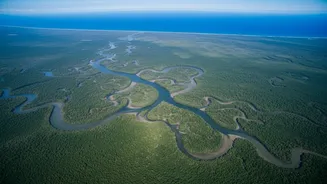
The Sundarbans is more than just a UNESCO World Heritage site; it's a critical ecosystem for India and Bangladesh, acting as a natural barrier against cyclones and a rich hub of biodiversity. For decades, however, its sheer scale and treacherous, waterlogged
terrain have made it incredibly difficult to study. Understanding its health, growth, and overall condition has largely been a process of patchwork field studies, which are vital but can't capture the full picture. This is especially true when trying to quantify one of its most important but invisible functions: pulling carbon dioxide from the atmosphere. To truly grasp its role in the fight against climate change, scientists needed a better, broader view.
Eyes in the Sky: A Technological Leap
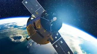
Enter the era of advanced remote sensing. Satellites equipped with a suite of powerful sensors now orbit the Earth, providing an unprecedented stream of data about our planet's forests. These aren't just simple cameras taking pictures. Technologies like LiDAR (Light Detection and Ranging) send laser pulses down to the surface, measuring the height of the forest canopy in stunning three-dimensional detail. Meanwhile, radar sensors can penetrate cloud cover and even the forest canopy to measure things like biomass—the total weight of trees, branches, and roots where carbon is stored. Optical satellites like the Sentinel series provide high-resolution images across different light spectrums, allowing scientists to calculate health indicators like the Normalised Difference Vegetation Index (NDVI) and Leaf Area Index (LAI), which are proxies for forest density and vigour.
From Data Points to Forest Density
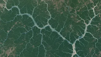
Gathering the data is only the first step. The real magic happens when scientists and machine learning algorithms process these billions of data points. By combining LiDAR's height data with radar's biomass estimates and optical imagery's health indicators, researchers can build incredibly detailed models of the forest. These models can distinguish between dense, healthy mangrove patches and areas that are sparse or under stress. This allows for an accurate, large-scale assessment of forest density—a key metric. A denser forest, with more leaves and a more complex structure, generally means more photosynthesis, more growth, and, crucially, more carbon being captured.
The Blue Carbon Connection
Mangrove forests are champions of what is known as 'blue carbon'. This refers to the immense amount of carbon stored in coastal and marine ecosystems. Through photosynthesis, mangroves absorb atmospheric CO2, storing it in their leaves, trunks, and extensive root systems. What makes them exceptional is their ability to trap and bury carbon in the oxygen-poor soil beneath them, where it can remain locked away for centuries or even millennia. Studies show that mangroves can sequester carbon at a rate up to ten times greater than mature tropical forests, making them one of the most efficient carbon sinks on the planet. The density of the forest is directly linked to how much carbon it can capture and store, making the data from satellite sensors invaluable.
A Verdict on the Sundarbans
Recent studies integrating satellite data from missions like Sentinel-2 have provided powerful insights into the Sundarbans. Research analysing data from 2019 to 2023 has successfully modelled the Gross Primary Productivity (GPP)—a measure of photosynthetic carbon fixation. These studies confirm the Sundarbans acts as a colossal carbon sink, with annual uptake estimated to be between 43 and 65 million metric tons of CO2 equivalent. To put that in perspective, in some years, this sequestration offset nearly a quarter of Bangladesh's entire national CO2 emissions. While the data also shows fluctuations and potential stress on the forest in certain years, the overall finding is clear: the Sundarbans is performing a massive, quantifiable service for the climate.
The Future of Forest Monitoring
The ability to accurately track mangrove density and carbon sequestration from space is a game-changer for conservation. It provides hard evidence of the value of these ecosystems, strengthening the case for their protection and restoration. Governments can use this data to better manage conservation efforts, track the success of restoration projects, and even participate in carbon markets. For a nation like India, which has vast stretches of coastline, this technology offers a powerful tool to monitor and protect its natural climate defences, ensuring that vital ecosystems like the Sundarbans can continue their silent, essential work for generations to come.