







From a Blurry Map to a High-Resolution Grid
For decades, weather prediction in India operated on a massive scale. The IMD would provide forecasts for large meteorological subdivisions or, most famously, a single number representing the country's average rainfall. While useful for a big-picture
overview, this approach often failed to capture the monsoon's notoriously fickle nature. One part of a district could be flooding while another remained parched, a reality lost in the averages. This new initiative flips the script entirely. The focus is now shifting to hyper-local, or granular, forecasting. By zooming in on administrative blocks—smaller units within a district—the IMD aims to provide information that is far more relevant and actionable for the people on the ground.
Why the Big Change Now?
The push for greater precision is a direct response to a changing climate. As weather patterns become more erratic and extreme events more frequent, the limitations of broad-scale forecasting have become dangerously apparent. A national average offers little help when planning for a potential flash flood in a specific valley or a dry spell affecting a particular cluster of villages. Moreover, there is a growing demand from key sectors, especially agriculture, for data that can drive real-time decisions. The new system is powered by cutting-edge technology, including artificial intelligence, which integrates vast amounts of data from satellites, Doppler radars, and automatic weather stations to produce more accurate and localized predictions.
What the New Forecasts Will Look Like
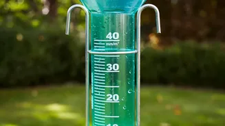
Instead of just knowing whether the monsoon will be 'normal' for the country, you will soon get specific details for your area. The new AI-enabled model can predict the advance of the monsoon at the block level up to four weeks ahead of time. In a special pilot project for Uttar Pradesh, the resolution is even more stunning, with forecasts being generated for a 1-kilometre grid. This means advisories will be able to pinpoint potential rainfall, its intensity, and its timing with a level of accuracy that was previously unimaginable. The system combines these predictions with historical data and global weather models to create a more reliable outlook.
A Revolution for Indian Agriculture
Nowhere will this impact be felt more than in the fields. Agriculture in India has often been described as a 'gamble on the monsoon', with livelihoods depending on the whims of the weather. This new system aims to take some of that gamble out of the equation. With precise, block-level forecasts, farmers can make informed decisions about when to sow their seeds, how much to irrigate, and when to apply fertilisers or pesticides to avoid them being washed away. It empowers them to shift from a reactive stance—coping with whatever the weather brings—to a predictive one, where they can plan their entire crop cycle based on reliable data. Early studies on similar localised advisories have shown they can reduce cultivation costs and significantly boost crop productivity.
Beyond the Farm: Safer Cities and Better Planning
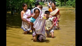
The benefits of hyper-local forecasting extend far beyond agriculture. For urban planners, this data is critical for managing the perennial problem of city flooding. Knowing which specific parts of a city are likely to receive a heavy downpour allows authorities to prepare drainage systems, manage traffic, and issue timely warnings to residents. District administrations can use these forecasts for more effective disaster management, prepositioning response teams and resources in areas identified as vulnerable to landslides or floods. It's a foundational shift towards building a more climate-resilient nation, one district at a time.
The Road Ahead
The initial rollout covers nearly 3,200 blocks, primarily in the rain-fed agricultural zones of the country, with plans for gradual expansion. While the technology is powerful, the ultimate success of this initiative will depend on its effective dissemination. The challenge lies in ensuring that these detailed forecasts reach every last farmer and local administrator in a simple, understandable format. The IMD is working to share these outputs through various channels, but bridging the final-mile communication gap will be key to unlocking the full potential of this revolutionary forecasting system.