







A New Eye in the Sky for India
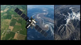
NISAR is a landmark collaboration between the Indian Space Research Organisation (ISRO) and the National Aeronautics and Space Administration (NASA). Launched in mid-2025, this Earth-observing satellite is equipped with advanced radar instruments designed
to create incredibly detailed maps of our planet's surface. While its applications are vast—from tracking earthquakes to melting glaciers—one of its most significant promises is for Indian agriculture. By providing unprecedented data on land and water, NISAR aims to empower farmers and policymakers, strengthening food security in an era of climate uncertainty.
The All-Weather Advantage of Radar
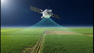
What makes NISAR a game-changer is its use of Synthetic Aperture Radar (SAR). Unlike traditional optical satellites that need clear skies and daylight to capture images, SAR can see through clouds, fog, and darkness. This is a crucial advantage for a country like India, where monsoon clouds can obscure the ground for months. The satellite sends microwave pulses to the Earth's surface and analyses the signals that bounce back, creating detailed images regardless of the weather or time of day. This ensures a consistent and reliable stream of data every 12 days, allowing for near-real-time monitoring of agricultural landscapes.
Dual Frequencies for Deeper Insights
NISAR is the first satellite mission to use two different radar frequencies, known as L-band and S-band. This dual-frequency capability provides a more comprehensive picture of the land. The longer wavelength L-band, provided by NASA, can penetrate the canopy of crops and forests to measure the moisture in the soil beneath. The shorter wavelength S-band, an ISRO contribution, is excellent at capturing fine details of the surface, such as crop structure and biomass. Together, they offer a powerful tool to assess everything from how much water is available to a plant's roots to how much the plant has grown.
From Soil Moisture to Smarter Farming
One of the most direct benefits for farmers will be highly accurate soil moisture maps. NISAR can produce these maps at a 100-metre resolution, a significant improvement over previous technologies. This level of detail allows for the identification of water-stressed areas within a district or even across a group of farms. For the individual farmer, this data can lead to more efficient irrigation, saving precious water and reducing costs. For policymakers, it allows for better drought prediction and management, ensuring resources are directed where they are most needed. The data will be made accessible through ISRO's Bhoonidhi portal, putting actionable intelligence into the hands of users across the country.
A Boost for Crop Health and Yield
Beyond water, NISAR's data will provide vital information on crop health and growth from planting to harvest. By analysing the radar signals, scientists can estimate crop biomass, which helps in predicting yields with greater accuracy. The satellite can differentiate between crop types and monitor their development, helping to create a detailed, real-time picture of agricultural production across the nation. This information is invaluable for managing food supply chains, optimizing the use of fertilisers, and providing farmers with timely advisories that can improve their output and income. It's about giving farmers the right information at the right time to make the best decisions for their fields.