




A Forest That Breathes with the Tides
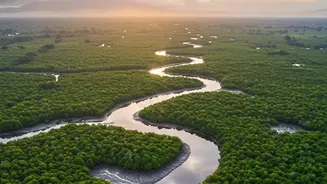
Spanning over 10,000 square kilometres across India and Bangladesh, the Sundarbans is a UNESCO World Heritage Site unlike any other. It is not a static forest but a dynamic delta where freshwater from the Ganges and Brahmaputra rivers meets the saltwater
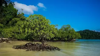
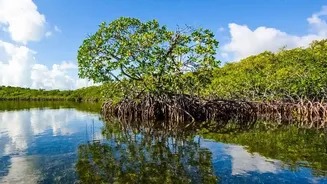
of the Bay of Bengal. This unique environment supports an incredible array of life, from the iconic Royal Bengal Tiger to saltwater crocodiles, spotted deer, and hundreds of bird species. For the millions living along the coast, these mangroves are a lifeline. Their dense, tangled root systems act as a natural barrier, absorbing the impact of storm surges and cyclones that frequently batter the region. They stabilise the coastline, prevent erosion, and serve as critical carbon sinks, capturing vast amounts of carbon dioxide from the atmosphere.
The Challenge of Mud, Water, and Tigers
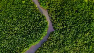
Monitoring the health of such a vast and treacherous landscape has always been a monumental challenge. Traditional ground-based surveys, while providing detailed data, are difficult, dangerous, and expensive. The terrain is a labyrinth of tidal creeks, deep mud, and dense vegetation. Navigating this landscape on foot or by boat is slow and covers only a tiny fraction of the total area. Add to that the presence of tigers and crocodiles, and you have one of the most hazardous research environments on the planet. For decades, this has made it difficult to get a complete picture of the forest's health, to see how it is changing over time, and to measure the success of regeneration efforts after events like supercyclone Amphan, which devastated large tracts of the forest.
Eyes in the Sky: How Satellites See the Forest
This is where satellite technology comes in. From hundreds of kilometres above Earth, remote sensing satellites provide a comprehensive, repeatable, and non-invasive way to watch over the Sundarbans. Organisations like the Indian Space Research Organisation (ISRO) and the Forest Survey of India (FSI) use a suite of satellites to gather data. These satellites are equipped with advanced sensors that capture light beyond what the human eye can see. Multispectral sensors on satellites like Landsat and Sentinel-2 measure energy across different wavelengths. Healthy, dense vegetation, for example, absorbs red light for photosynthesis and strongly reflects near-infrared (NIR) light. By comparing the values of these light bands, scientists can calculate what is known as the Normalised Difference Vegetation Index (NDVI). Think of it as a 'greenness' score or a health check for the forest, where higher values indicate denser, healthier vegetation.
From Pixels to Performance Metrics
Each pixel in a satellite image becomes a data point, allowing researchers to build a detailed map of the forest's condition. By analysing this data, they can measure key performance indicators of mangrove regeneration. The most basic metric is 'extent'—the total area covered by mangroves. Time-series analysis, comparing images from different years, reveals whether the forest is expanding or shrinking. But it goes deeper than that. Scientists can classify the forest into categories like 'dense forest', 'moderate forest', and 'sparse forest' to understand its overall structure and identify areas of degradation. They can also track changes in the shoreline to see where land is being lost to erosion and where new mudflats are forming, creating opportunities for natural mangrove colonisation. This data is crucial for targeting afforestation efforts and confirming whether planted saplings are surviving and growing into a resilient forest shield.
A Data-Driven Future for Conservation
The insights gained from satellite tracking are transforming how the Sundarbans are managed. After a major cyclone, scientists can quickly assess the extent of the damage to the mangrove canopy, identifying the worst-hit areas that need immediate attention. Long-term data helps to distinguish between cyclical changes and worrying trends, such as the gradual replacement of high-value freshwater-loving mangrove species with more salt-tolerant varieties due to rising salinity. This information enables forest departments and conservation groups to make smarter, evidence-based decisions. It helps them pinpoint where to build protective embankments, where to focus community-led plantation drives, and how to allocate resources more effectively. While challenges like rising sea levels and reduced freshwater flow remain, this technology provides a powerful tool in the ongoing effort to preserve this invaluable ecosystem.