








India's Eyes Over the Oceans
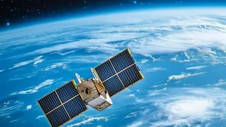
High above the Earth, moving at roughly seven kilometres a second, is a testament to India's scientific prowess: the OceanSat series of satellites. The latest in this lineage, OceanSat-3, also known as Earth Observation Satellite-6 (EOS-06), was launched
in November 2022. This advanced satellite is part of a multi-mission endeavour to ensure the continuity of crucial ocean data. Its primary goal is to observe our oceans in unprecedented detail, monitoring everything from ocean colour and sea surface temperature to wind patterns. This data serves a dual purpose that is vital to the nation: bolstering the livelihoods of millions who depend on the sea and safeguarding coastal populations from extreme weather events. These satellites are the foundation of a sophisticated system that translates space data into actionable intelligence on the ground.
How Satellites See the 'Colour' of the Sea
The satellites don't actually see fish from orbit. Instead, they find their food. The key lies in a remarkable piece of technology called the Ocean Colour Monitor (OCM). This instrument is essentially a highly sensitive camera that measures the subtle variations in the colour of seawater by analysing how sunlight scatters off the surface. The specific shades of blue and green it detects reveal the concentration of chlorophyll, the pigment found in microscopic marine plants called phytoplankton. Since phytoplankton form the base of the marine food web, attracting small fish which, in turn, attract larger, commercially valuable fish, a high concentration of chlorophyll is a strong indicator of a potential fishing ground. In essence, ISRO doesn't spot the pomfret; it finds the restaurant where it's likely to be feeding.
Guiding Fishermen to a Better Catch
The raw satellite data is just the beginning. It is sent to the Indian National Centre for Ocean Information Services (INCOIS) in Hyderabad. There, scientists process the ocean colour and sea surface temperature data to generate Potential Fishing Zone (PFZ) advisories. These advisories, which pinpoint the exact latitude, longitude, and depth of likely fish aggregation, are disseminated daily to fishing communities across India's 7,500-kilometre coastline. This service is provided in local languages and sent out through various channels, including mobile apps and specialised terminals. The impact is enormous. By heading directly to these zones, fishermen save significant amounts of time and diesel, reducing operational costs and carbon emissions. Studies have shown dramatic increases in income for those who use the advisories compared to those who search for fish randomly.
Reading Weather from the Waves
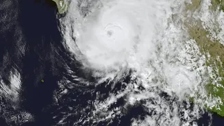
Beyond fishing, the OceanSat programme is a cornerstone of India's weather forecasting and disaster management systems. OceanSat-3 carries a Sea Surface Temperature Monitor (SSTM) and a Ku-Band scatterometer (SCAT-3) that provide critical data on ocean temperature and surface wind vectors, respectively. Sea surface temperature is a crucial parameter for predicting the genesis and intensification of cyclones in the Arabian Sea and the Bay of Bengal. The INSAT and OceanSat satellites work in tandem to monitor storm evolution, track, and landfall, allowing meteorological agencies to issue timely and accurate warnings. This capability saves countless lives and allows authorities to prepare coastal communities for impending threats. The data is also vital for studying and forecasting the behaviour of the Indian monsoon, a weather system that is the lifeblood of the nation's agriculture and economy.
A Pillar of India's Blue Economy
The applications of OceanSat data extend far beyond daily fishing and weather reports. This constant monitoring helps scientists track the health of marine ecosystems, such as identifying harmful algal blooms or coral bleaching events caused by rising sea temperatures. It aids in coastal zone management by observing sediment movement and contributes to global climate change studies by measuring the ocean's role in the carbon cycle. By providing a wealth of information, ISRO's ocean-observing satellites are becoming an indispensable tool for managing India's marine resources sustainably. They represent a critical investment in the nation's burgeoning "Blue Economy," ensuring that economic development and environmental stewardship can go hand in hand for generations to come.